
Adventure Kokoda Blog
Protecting our heritage
Kokoda is much more than a trek. It is almost a spiritual journey for those who wish to connect to the historical significance of the Kokoda campaign. It is also an empathetic bridge for Australians and Papua New Guineans to better understand each other.
Our Charity
Our charitable work includes the provision of health support, school supplies, scholarships, and emergency medical assistance to villagers across the Kokoda Trail.
Our Media
National features stories of our treks on all major television networks, newspapers, and magazines.
Our Reviews
Trekker feedback, Trip Advisor reviews, and personal reflections.
Our Treks
Everything you need to know about our treks, our trekkers, training tips, gear selection, and some handy hints.
Our Viewpoint
Charlie has been the leading advocate for the protection of our Kokoda heritage, and the welfare of villagers across the Trail, for 30 years.
PAPUA NEW GUINEA
Interesting articles relating to our close association with PNG, and our shared wartime heritage.
Latest News

Losing Kokoda
The ‘blackbirding curse’ is as damaging to Papua New Guinea’s adventure tourism industry as the ‘resource curse’ is to mining and exploration. ‘Blackbirding’ was a term given to the coercion of native people from Papua New Guinea to work as cheap labour in...
Wartime Tourism: The Ties that Bind
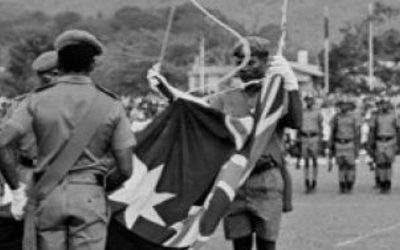
An open letter to the PNG Flag Officers League: PNG is in urgent need of your collective wisdom and your selfless, patriotic leadership. Members of your league understand that pride and an ethos of service before self are essential qualities of any disciplined force....
CHAPTER 22: Potential of a Wartime Tourism Industry for PNG
Papua New Guinea is the custodian of battlesites which cost the lives of thousands of young men from Australia, Japan and the United States during the War in the Pacific from 1942-1945.
Since the war many of these sites have been visited by kinfolk on personal pilgrimages to pay their respects to loved ones.
Thus far there has been no effort by the PNG Government to seek the support of the three nations to fund military heritage site plans to commemorate and interpret them.
Envirocrats Hijack Kokoda
In 2008 Australia developed a ‘Joint’ Agreement with the PNG Government in regard to the management of the Kokoda Trail and its surrounding environs. The lead agency was the Department of Environment, Water, Heritage and the Arts (later rebadged as the Department of...
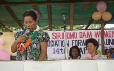
Official Launch of the Sirinumu Dam Women’s Association
We were proud to host the official launch of the Sirinumu Dam Women’s Association at our Network Kokoda Community Learning Centre on 14 April 2016.
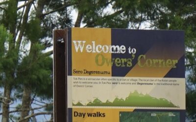
Dodgy DFAT Deal for Interpretive Panes at Owers Corner
The tender for the design, development and construction of the interpretative panels was awarded to ‘The Interpretative Design Company’ based in Coffs Harbour. According to their website the contract was ‘for the provision of interpretive services to the Australian...