
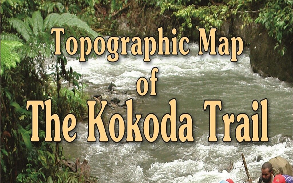
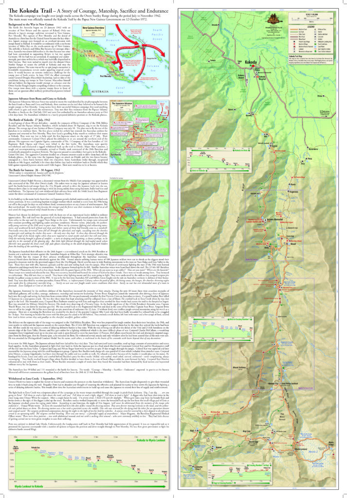
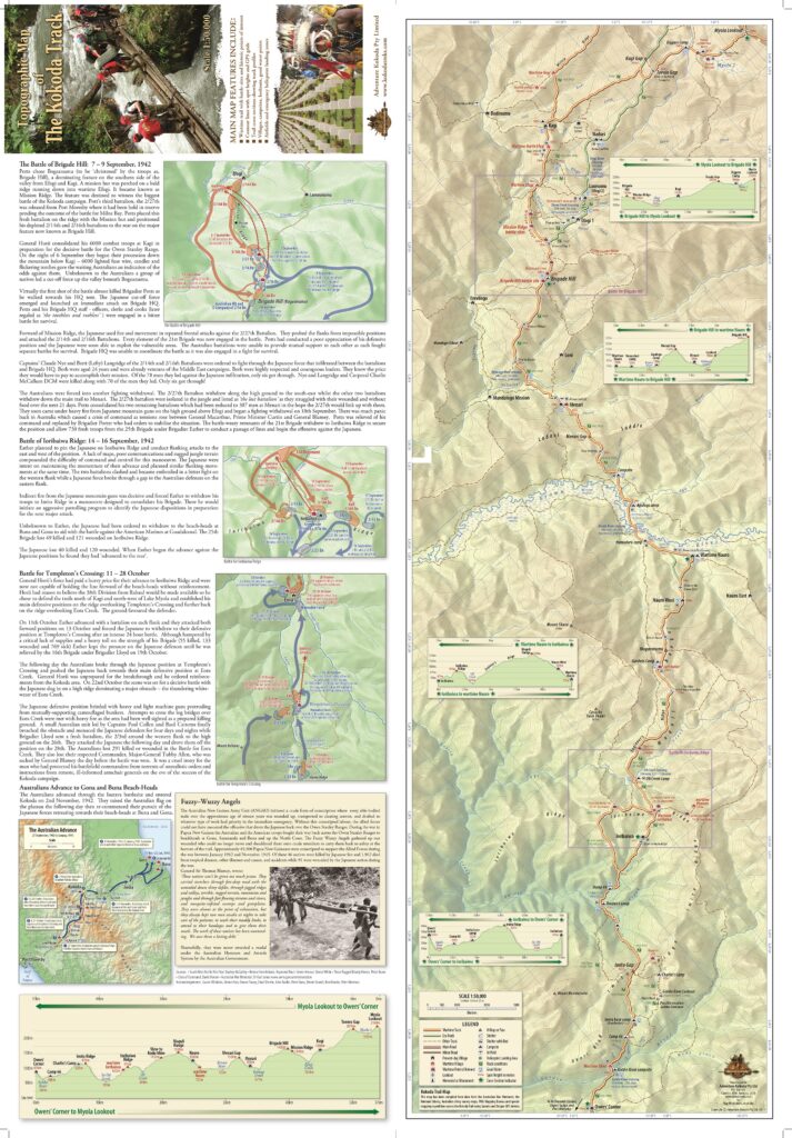
”Kokoda Trail’ was the offical name of the waritme tracks between Owers’ Corner and Kokoda gazetted by the PNG Government in 1972 (PNG Government Gazette No. 88 of 12 October 1972, page 1362, column 2. Notice 1972/28 refers). The gazetted area extends to 10 metres either side of the Trail. It is also the name of the official Battle Honour, awarded to the Papuan Infantry Battalion and the 10 Australian battalions who fought in the Kokoda campaign, by the Commonwealth Battles Nomenclature Committee in 1953.
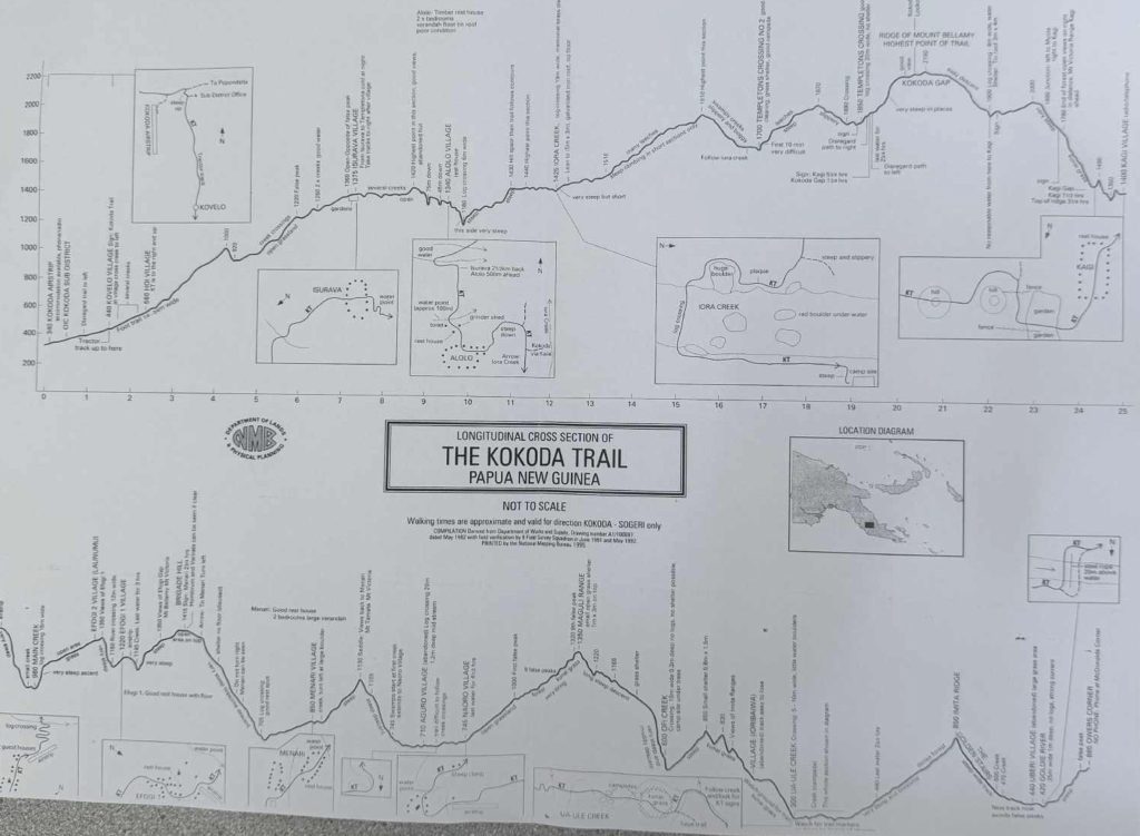
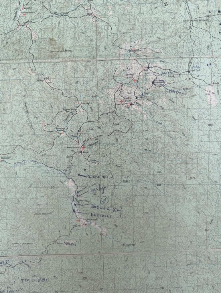
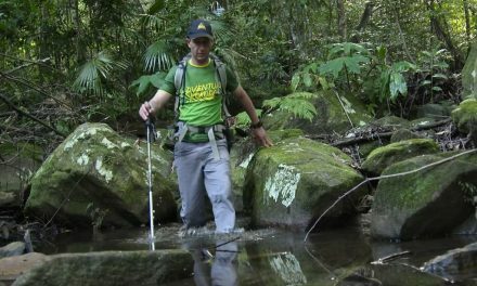
The lack of an accurate topographic map of the Kokoda Trail was a vital gap when we pioneered trekking along it in the early 1990s. The only topographic map available was a 1:100,000-scale Army Survey Corps map published in 1984. However, the map scale and rugged terrain enabled plotting positions with a prismatic compass.
‘Prior to World War 2, very little survey and map information existed in New Guinea, and what did exist was of little use for the production of tactical maps. The first survey unit in New Guinea, 2 Field Survey Section, arrived at Port Moresby on 25 June 1942 and by August 1942, it had 3 officers and 48 other ranks out of an establishment of 68 all ranks. Section personnel were mostly only partly trained, their equipment was in short supply, and there was no aerial photography which would could be used in map production. The section’s initial tasks included fixation of anti-aircraft and searchlight positions and the determination of road and track locations from Port Moresby to Kokoda.
‘By mid-August 1942, the Section began to receive aerial photography of the Moresby Defence Area, the areas from Moresby to Sogeri Plateau, from Kokoda to Buna and from Gna Mission to Kokoda. During this photography, the Section produced a plan of the previously unmapped Kokoda area at a scale of 2 miles to 1 inch.
‘The KOKODA AREA map was published on 1 September 1942, and it covered the area from Kokoda to Lake Myola. Although it was provisional in nature, it provided greater detail than existed on the only other available maps at the time, the unreliable 4 mile to 1 inch Strategic Services.The KOKODA AREA map was used during the Australian withdrawal along the Kokoda Trail and then during the subsequent Australian advance against the Japanese. It was replaced by the KOKODA-MYOLA AREA map at a scale of 1 inch to I mile which was published on 27 October 1942.’
‘Adapted from accounts in ‘Lebanon to Labuan’ by Lawrence Fitzgerald, 1980
Produced by the Royal Australian Survey Corps Museum, 1992
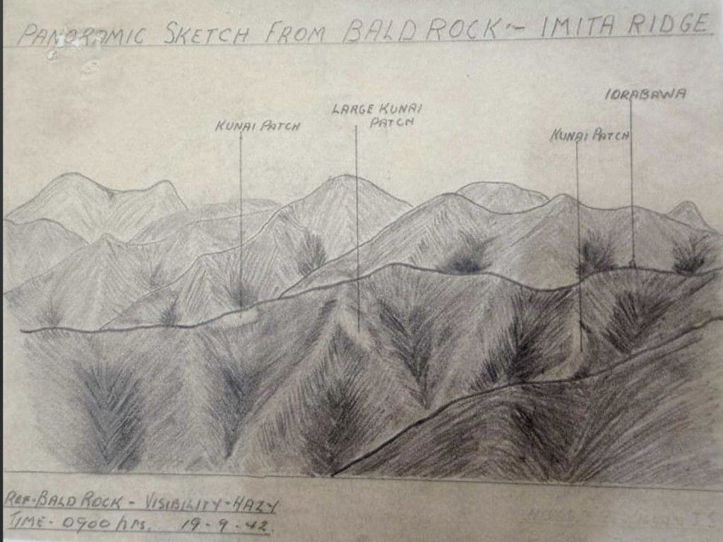
The introduction of GPS devices in the mid-1990’s partially solved the problem but did not overcome the shortcomings of such a large-scale map. However, it enabled us to verify key locations along the Trail, such as the Brigade Hill, Mission Ridge, and Isurava battle sites
We were hopeful that the development of an accurate topographic map would be a priority after Canberra took control of the Kokoda Trail in 2009, but it was not to be.
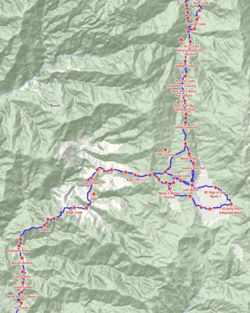
We therefore committed to creating an accurate map and identifying the indigenous names of all features along the Trail as part of the exercise.
We purchased new Garmin GPS devices for our senior trek leaders, including Commander Simon Hart, a former Naval Captain of HMAS Brisbane and HMAS Hobart; Major Chad Sherrin MM, a decorated Vietnam Veteran; and Lieutenant-Colonel Rowan Tracey, Australia’s foremost historian on the Kokoda campaign.
We then engaged a professional cartographer, Mr Laurie Whiddon, owner of Map Illustrations. Laurie was also an adventurer who used to leap from helicopters to ski down snow-covered mountain peaks.
During our various treks between 2010 and 2013, we recorded every feature and position along the Trail and uploaded our coordinates to Laurie Whidden, who then began to build our map.
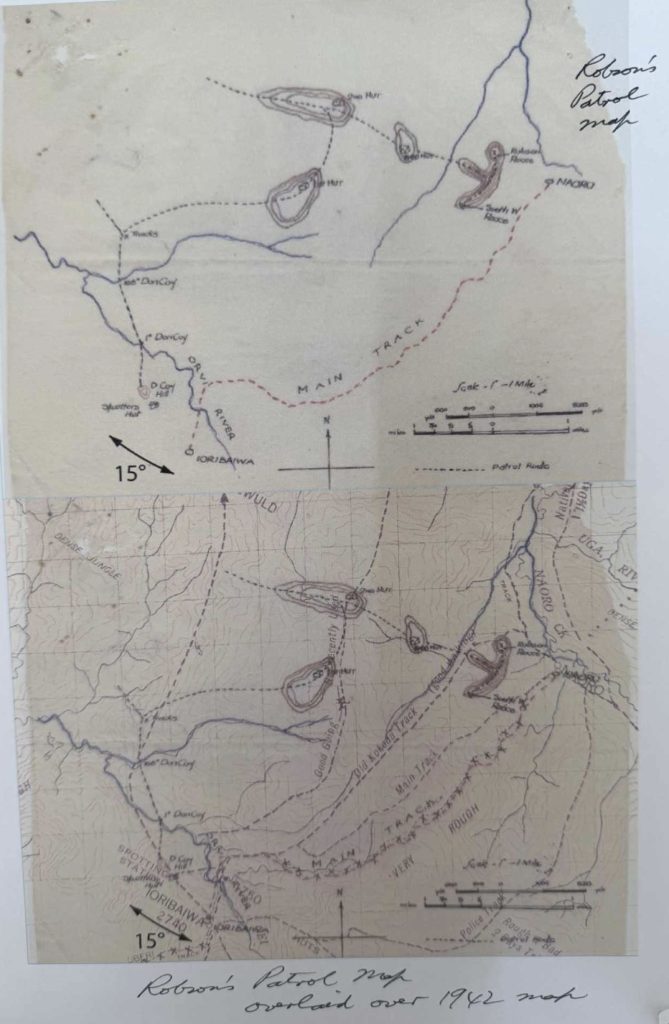
It was soon clear to us that the modern Trail bypassed many of the wartime locations.
To overcome this, I used to fly to PNG, engage a few of our guides and some local landowners across various sections of the Trail, and use the Army Survey Corps map to plot the original Trail. During this process, I learned that every feature, rockface, creek, and similar element had a name. I would then ask the landowner to spell it phonetically and enter it into my GPS. This was a time exercise as I also learned that many of the younger guides are not aware of the indigenous names.
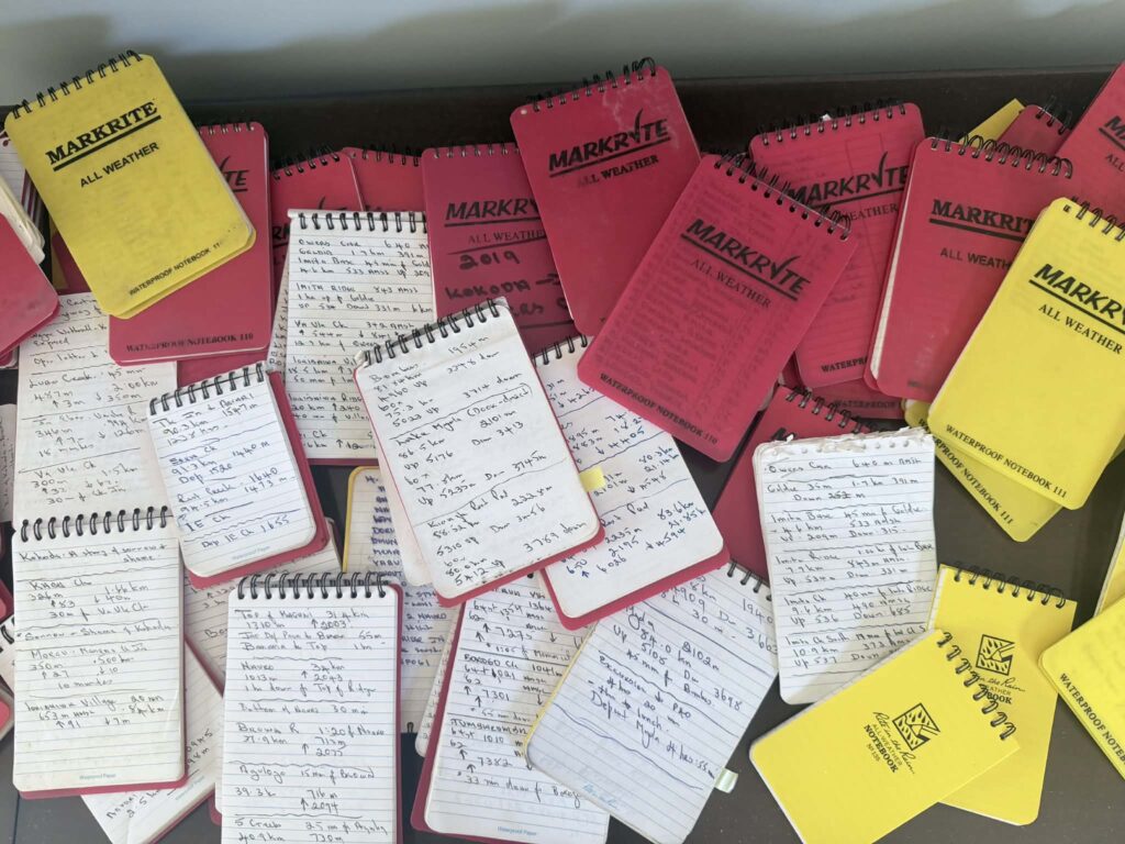
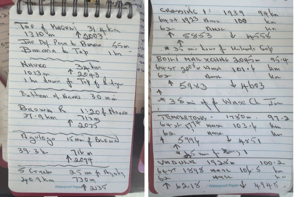
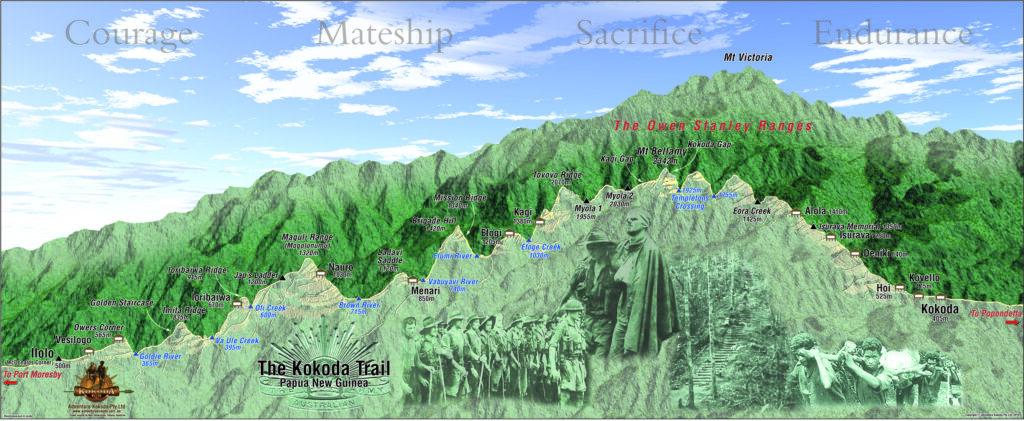
I also recorded the times, distances and names in waterproof notebooks on every trek I completed between 2010 and 2023. This was an interesting exercise, as I had to be mindful to turn off my GPS whenever we stopped at a campsite or feature, so it would not record the distance I walked around each location. This ultimately led to the conclusion that the distance of today’s Kokoda Trail between Owers Corner and Kokoda is 124 km, with a total ascent of 6,658 metres and a total descent of 6,683 metres. Groups that include Lake Myola 1 and 2 will trek a total distance of 152 km, with a total ascent of 7,150 meters and a total descent of 7570 meters.
Our team then spent many hours with Laurie Whiddon as he revised the drafts of the information we provided.
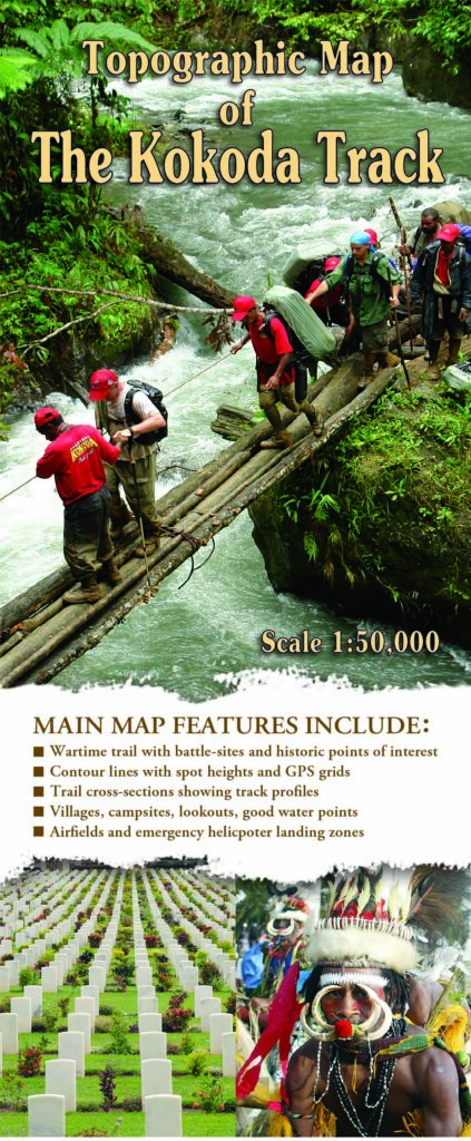
The result was the following 1:25,000 topographical map of the Kokoda Trail. Our work was verified by the investigators into a fatal aircraft accident in 2009. They requested permission to use our map as it was the only accurate map available. They acknowledged this fact in their final report.
Despite this, officials from both Canberra and PNG, who have never left the comfort of their offices, continue to insist that the Kokoda Trail is 96 km! This distance seems to orignate from pilots who measure it ‘as the crow flies’. However, if they were to strap a GPS to the leg of a crow they would find the zig-zagging they would have to make aroung features and across rivers and creeks would increase the distances significantly!

