
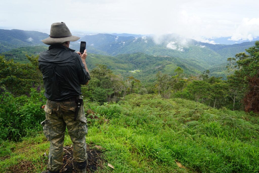
‘Mapping and measuring the Kokoda Trail was an exciting venture.
‘As I became more familiar with the Trail over the years, I used to ask our guides the names of various creeks and features. I soon learned that every nook and cranny along the trail has an indigenous name.
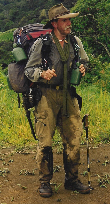
‘I was frustrated that these were not recorded anywhere so I purchased a Garmin GPSMAP 60 and acquired official maps from the Royal Australian Army Survey Corps. These had been compiled from a series of air photos and sketch maps drawn during the Kokoda campaign.
‘During my Parliamentary breaks I would go to PNG and select a small group of local guides from the area I planned to map and spend a few days with them trying to identify the original wartime trail from the army survey maps.
‘These were some of my best days.
‘Each time we came to a place, creek or feature I would ask them the name. They would have a group discussion then spell in phonetically for me. Whenever there was a phonbetic difference between, say and ‘i’ and an ‘e’ for example I would take a vote and record the majority decision into my GPS.
‘Another challenge we faced early on was ending up in a ravine in thick, almost impenetrable scrub. I would explaind that when I indicated direction to the lead group I expected them to ‘read the ground’ as their fathers and army patrols would have. Once we got the routine down pat it was an experience we all enjoyed.
‘Our guides were proud to be part of an expedition that would improve the experience for future trekkers and I often reflect that there is no better experience than to be alone in the jungle with a group who were not only proud to be part of something special but who keep a keen watch on everything you do because of their concern for your safety.
‘On my return I would download the readings to our cartographer, Laurie Whiddon of Map Illustrations. Laurie was an adventurer who was keen to be part of the production of the first 1:25,000 topograph map for the Kokoda Trail.
‘We also provided Garmin GPSMAP 60s to our other trek leaders who included Major Chad Sherrin MM, a Vietnam Veteran and former army jungle training instructor; Commodore Simon Hart CSC, a former Naval Captain of two frontline battleships (HMAS Brisbane and HMAS Hobart); and Lieutenant Colonel Rowan Tracey who is regarded as Australia’s most knowledgeable historian on the Kokoda campaign because of his strategic and tactical understanding of ‘ground’.
‘Laurie Whiddon constantly probed and tested us on the information we provided as he was pedantic in his quest for accuracy.
‘Our work was later acknowledged by investigators into the fatal air crash near Abuari in 1999. The Chief Investigator called to see if we would allow them to use our map as part of their investigation as it was the only accurate map he could find in Australia or PNG. We were obviously happy to oblige’
The Hon, Major Charlie Lynn OAM OL (PNG) Rtd
‘Kokoda: 100 Treks’ by Glenn Armstrong
So what is the correct distance of the Kokoda Trail?
Mapping the Trail was easy as all we had to do was enter the name of the location into our Garmin GPS and technology did the rest.
Measuring was a different challenge requiring disciplined focus on the task. For example when we moved around our campsites or wandered around a village the GPS recorded the distance which added a few kilometres. We therefore had to establish the habit of turning it on and off every time we stopped during our 8 and 10-day treks.
Over a three year period we were therefore able to determine the following data:
8-Day Trek:
- Total Distance: 124 km
- Total Climb: 6,658 metres
- Total Descent: 6,683 metres
10-Day Trek:
- Total Distance: 152 km
- Total Climb: 7150 metres
- Total Descent: 7570 metres
Our starting point in 1991 – a 1:100,000 Army Survey Map:
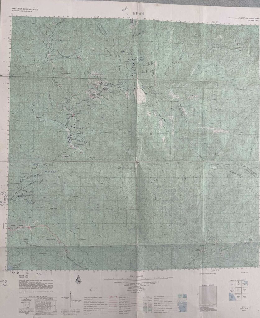
Royal Australian Army Survey Corps Edition 1AAS Series T683 ‘EFOGI’ 1974: Scale 1:100,000
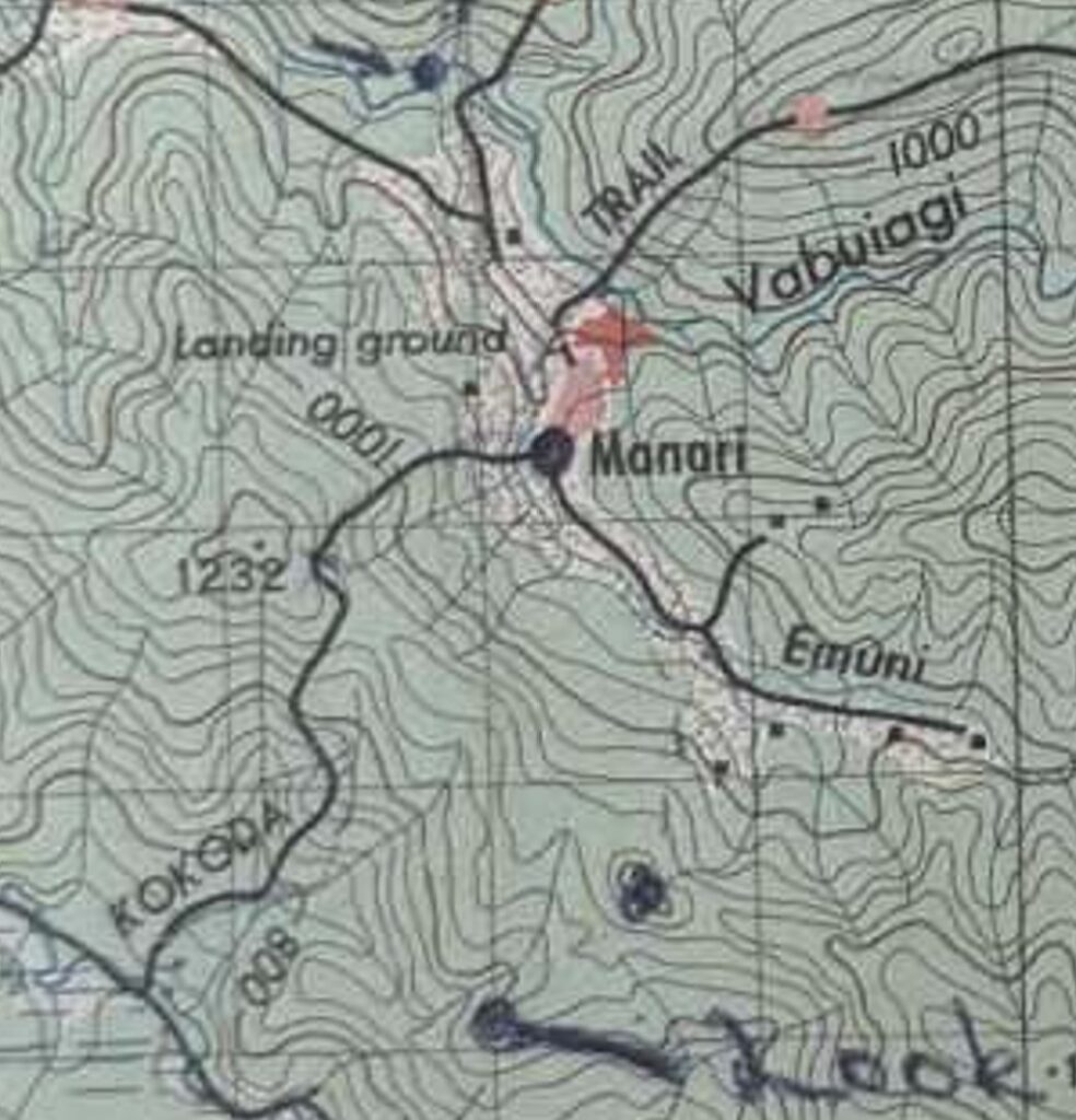
Note: The official Army Survey map of 1974 refers to the official name ‘Kokoda Trail’
Kokoda Trail sketch map by PNG Department of Works and Safety 1995
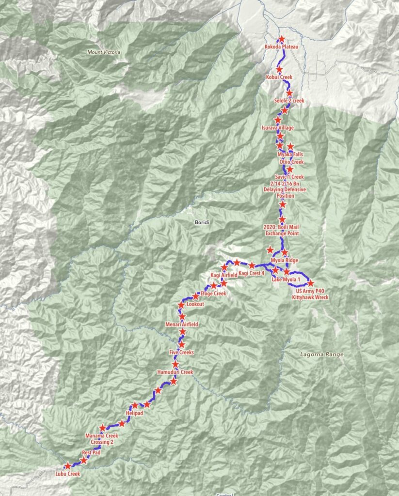
Our Kokoda Trail mapping expeditions: 2010-2013
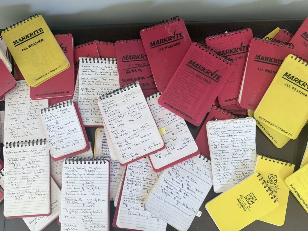
Extracts from our notebooks recording times, distances, heights and descents over the years

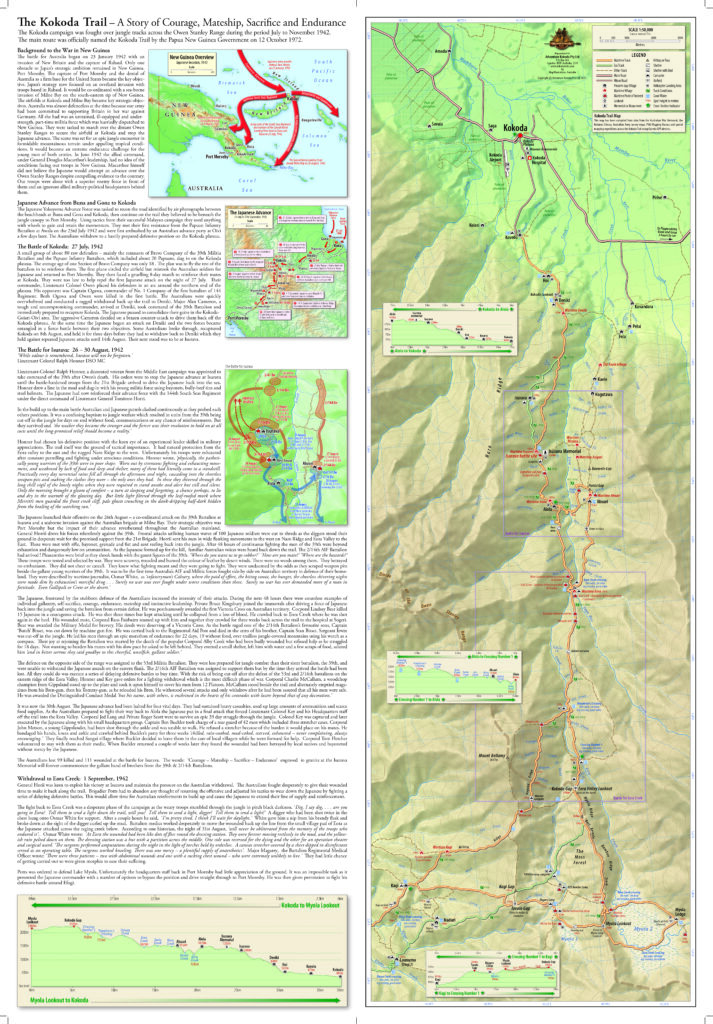
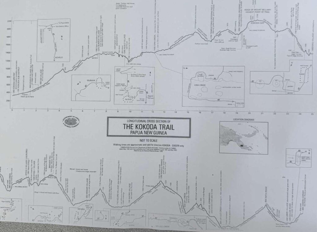
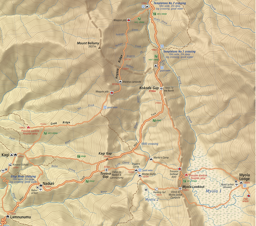
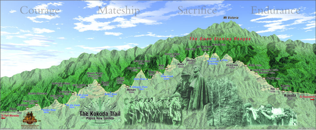
Northern section of the Kokoda Trail from Lake Myola to Kokoda with battle maps and trekking profile
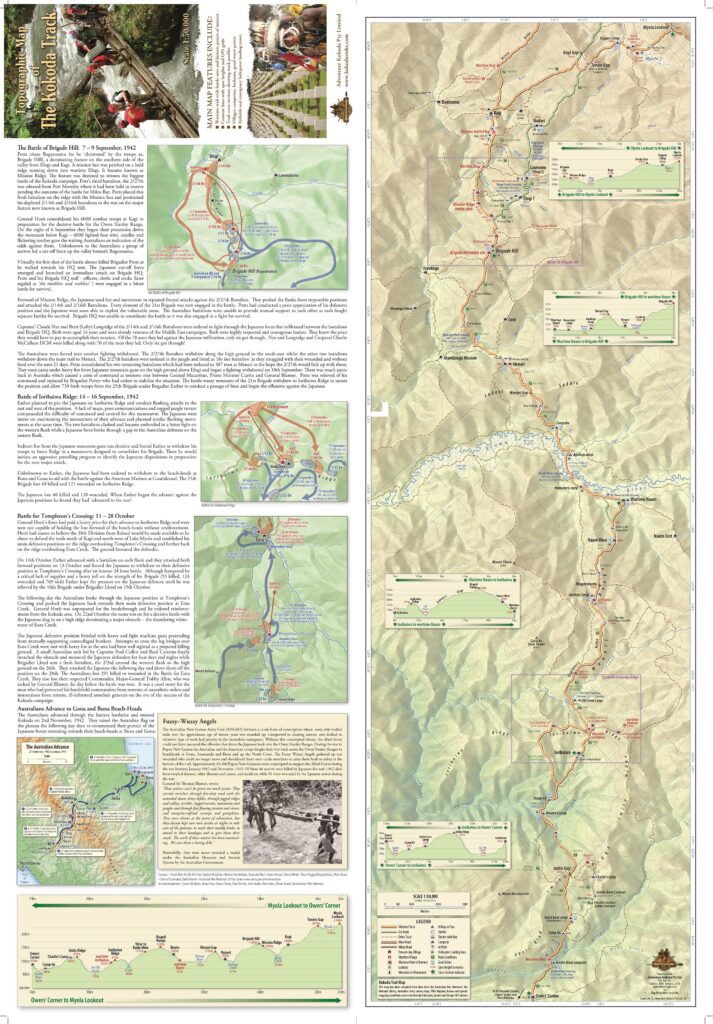
Southern section of the Kokoda Trail from Owers Corner to Lake Myola with battle maps and trekking profile

Owers Corner – Maguli Range – Ofi Creek
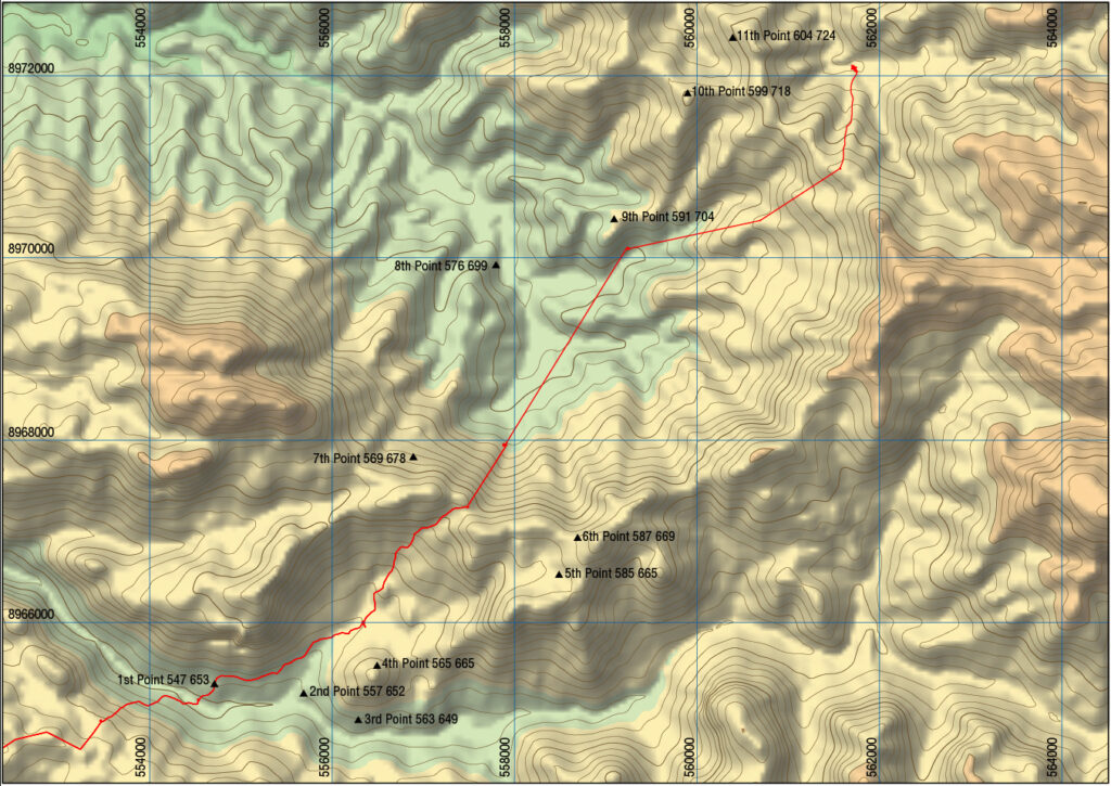
GPS plots for the original wartime trail between Owers Corner and Imita Ridge
Isurava battle map dispositions: 26-30 August 1942
Original wartime route used by 39th Militia Battalion during their advance from Kagi to Templeton’s Crossing

OUR ADVENTURE KOKODA ‘MAPOUT’ GEOGRAPHIC SERIES
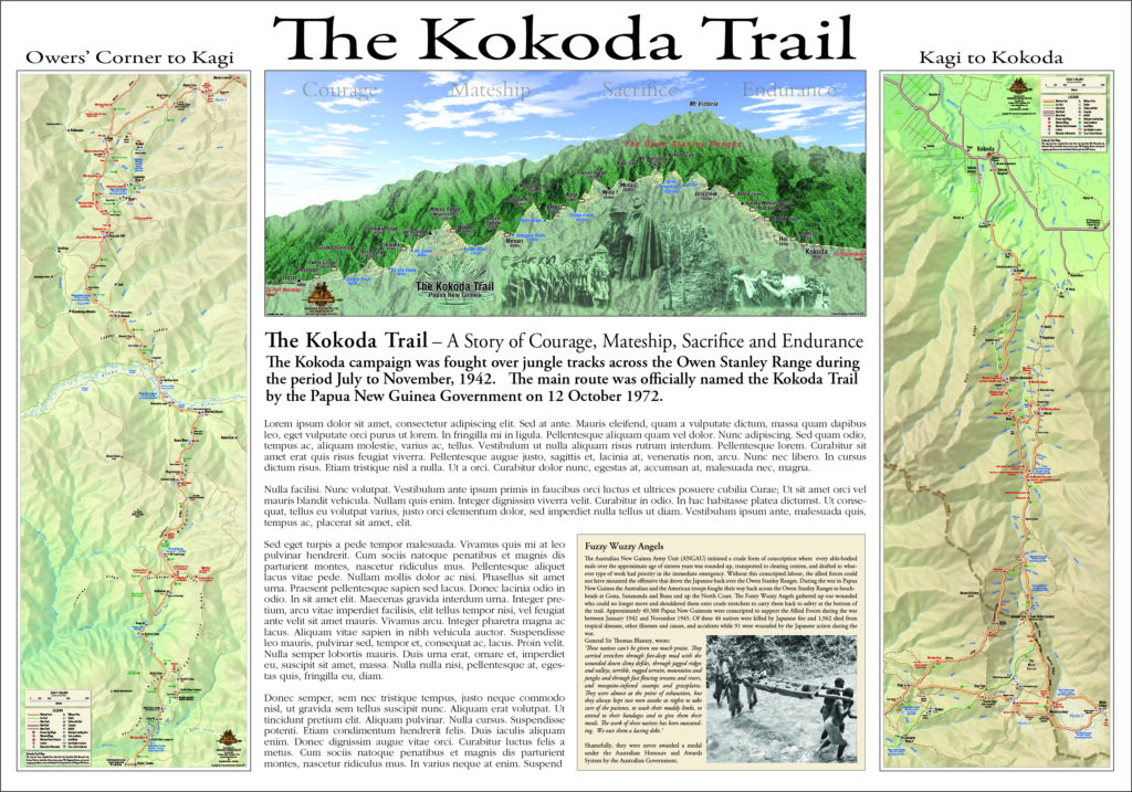
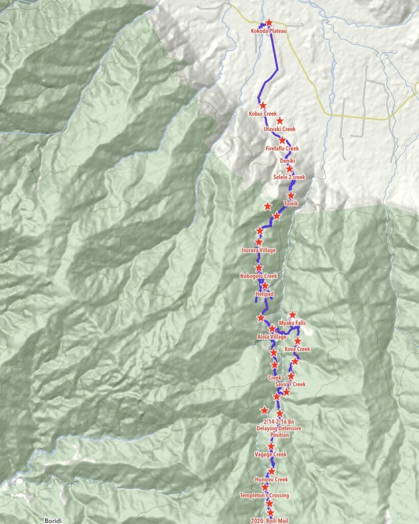
Owers Corner to Kokoda

Owers Corner to Brigade Hill
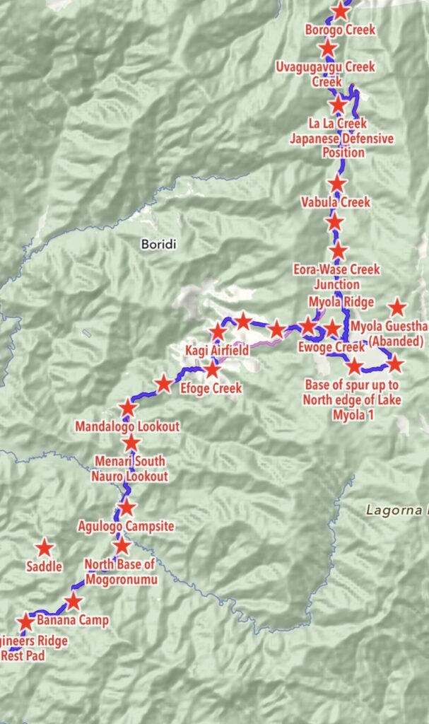
Engineers’ Ridge to Borogo Creek
Mandalogo Lookout south of Brigade Hill to Ai Creek at Kokoda
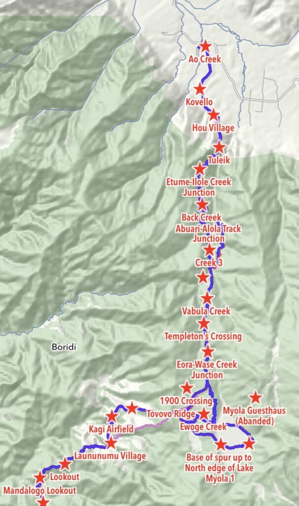
Templeton’s Crossing to Kokoda
OUR ADVENTURE KOKODA POSTER MAPS


