
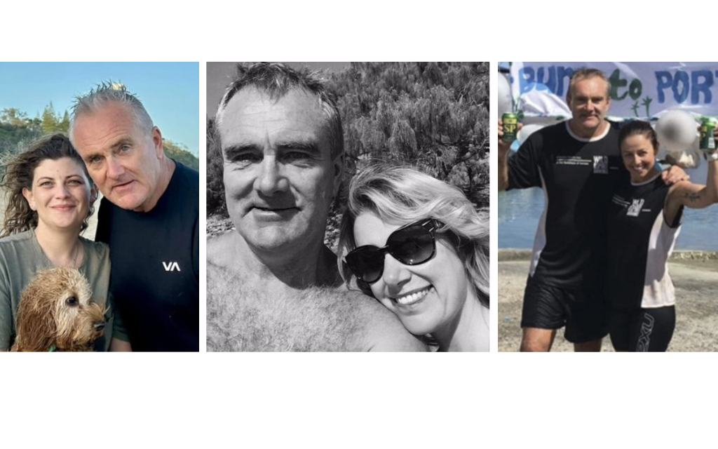
Wayne Wetherall’s transformation from a suburban salesman to a self-proclaimed Kokoda ‘adventurer, explorer, historian and philanthropist’ with his company, Kokoda Spirit, is a compelling tale – however his carefully crafted reputation is at odds with evidence presented to the Queensland Industrial Relations Commission in 2022 where it was revealed he had:
- Stalked vulnerable female trekkers;
- coerced one into having group sex with his mates;
- fathered an illegitimate child in PNG;
- traded sexual favours with his female staffer in Port Moresby;
- engaged in group sex with other men;
- exploited his PNG guides and porters; and
- bullied and harassed his female staff in Australia
Extracts from the Queensland Industrial Relations Commission Hearing
An unexpected appeal by Wetherall’s former female manager at a Queensland Industrial Relations Commission hearing from 27-30 September 2022 exposed the dark side of his character as revealed by the following extract from Day 1 of the hearing:
Barrister for Mrs Lynn Kelly:
‘Okay. So there were many messages about Mr Wetherall and his girlfriends, and there were many messages of Mr Wetherall trying to get his girlfriends to engage in group sex with many men.
Mrs Kelly:
“There were many messages where Mr Wetherall would try and engage or coerce his current girlfriend into a gangrape situation with five or six men.
“There were just many messages where he insisted on – initially, (name omitted) a PNG staff member in – who lived in PNG. She was one of our staff and when he was going to PNG, messages would pop up when they were talking that he would insist that she meet him in his hotel room when he arrived, so that she could – she could perform fellatio on him. He wouldn’t use that terminology, and she – her payment for that would be something like a bottle of Johnnie Walker Red.
“There were – there was much talk about the fact that he would speak to which ever girlfriend it was at the time about how he loved cock.‘He would refer to – he would – the language was really vulgar and obscene and there’s pornographic – there were many messages, but there was also many photos, and the photos were very graphic of – of people’s – like, women’s vaginas and women’s – men’s penises, of dildoes, of Mr Wetherall performing fellatio on another man . . .
’‘I was sick. I – I was shocked. Really shocked. I was – it bothered me a lot. I was – I was sick in the stomach over it. I – it was unbelievable. I’d never seen anything quite like that, so, yeah, my reaction was absolutely shock and sickness and – I – I just couldn’t – part of my brain just thought it was a joke. I just didn’t – I couldn’t believe it. It made me physically unwell. Like I said – I think I said earlier, there was much talk about, you know, my supposed stomach cancer . .
’‘Mr Wetherall constantly would try and reduce the wages of the PNG staff and porters and – and so – or their food allowance. We would do what we call trek expenses, so porters are allowed X amount of dollars to buy food for X amount of days on the Kokoda Track, and the way he would reduce his costs is always to take from the locals, whether it be their wages or their food supplements, and I – he would refer to me as either the Irish Union Rep or his Jiminy Cricket, because I would always fight to make sure that they – they didn’t have a pay increase, they just maintained what they should be getting by rights, because I felt that to reduce five kina from these people, which is probably $2.50 in our terms was a huge amount for them, and meant a lot to them and to us was nothing. So I would always try and keep him honest in that regard, and I guess .’‘I’m a mother of four children, and I’ve just learnt you put one foot in front of the other. I was a stay at home mother for a long time, and it didn’t matter whether I was sick or not sick, if I had children that needed me, you just kept going, and I think I just had that mindset. You just got to keep going and put one foot in front of the other and I simply – until I broke down in Dr Harrison’s office, I really didn’t realise that I was struggling or not coping with what was going on in the office.’
The outcome of the QIRC hearing was reported in the Brisbane Times on this link:
The full transcripts of the QIRC hearings containing more salacious evidence about Wayne Wetherall’s modus operandi can be viewed on this link:
The QIRC Commissioner included the following observations of Wetherall’s character in his judgement:
[57] Further, having had the opportunity to observe Mr Wetherall as he gave his evidence, I consider there was at all times a thinly veiled aggression permeating his demeanour. He was at times quite arrogant and aggressive in challenging questions put to him in cross examination in a way that went beyond mere defensiveness in my observation. His tone of voice and body language when under cross examination demonstrated clear hints of the volatility and propensity for anger that was described by Ms Kelly.
[65] The content of the messages and the descriptions of the images to which Ms Kelly was exposed (and the fact they involved Mr Wetherall) was never disputed by the Regulator. It is unnecessary for these reasons to describe them – Suffice to say they included messages and images of a graphic sexual nature that were authored by (and featured) Mr Wetherall.
Vietnam Veteran’s Character Assessment of Wayne Wetherall
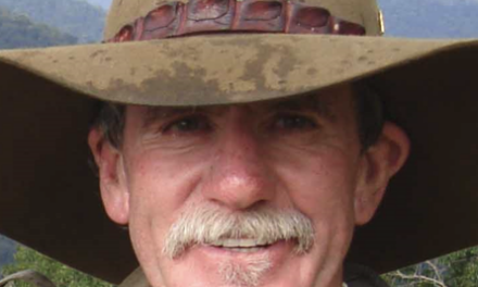
The first hint of Wayne Wetherall’s character flaws were raised by one of his trek leaders, a decorated Vietnam veteran 10 years earlier in 2011:
‘I led two dry season Track crossings for Wayne in 2009. The first, comprising a group of some six clients, went reasonably well. An overall assessment suggested to me that, prima facie, Wayne had his shit in order.
‘The second crossing for Wayne later that year, was however, an unmitigated disaster, and suggested to me that Wayne was flying by the seat of his pants, and that his organisation was a major accident waiting for a time and a place to happen. I forwarded a comprehensive assessment of the trek and his organisation to him and received in return only a brief acknowledgement of that report. Since that time, I’ve had essentially no contact with him.
‘It was very clear to me before, during, and after that second trek, that every facet of his organisation essentially failed to meet even the most rudimentary of common, garden variety trekking standards. It didn’t matter whether the issue was pre or post trek administration; support staff selection, management, development, competence and accountability arrangements; trek safety; or logistics: all seemed to perch precariously and consistently on a narrow knife edge, where the potential for significant problems to emerge were so obviously and consistently in evidence.
‘I concluded that report to Wayne with the following advice: “If it is your wish that KS continues to operate, and to prosper, professionally, on the Track, it is my opinion that a significant review of your Company’s philosophy, your standards and modus operandi is urgently required.‘It would be well beyond any possibility that I would trek for or with him again, nor would I in any way recommend any potential trekker to join his expeditions. I would not allow myself to be associated with him or his organisation.
‘My anecdotal-based overview of WW, gained inter alia, from a number of reputable sources whose opinion and judgement I would trust, and over the past seven years, is that he is a bullshit merchant of some standing, whose principal position in life seems to be based on a carefully planned programme of self-aggrandisement and self-promotion. Notwithstanding his clever self-marketing skills, his trekking “exploits” both on and off the Track appears to me to lack any real credibility, He seems somehow to survive on a predetermined network of manipulative exploitation of, at best, half-truths, something akin to a shonky second-hand car salesman!!’
So, Who is Wayne Wetherall?
So, Who is Wayne Wetherall? Where did he come from? Was he really a World Athletics Champion? Is he really an adventurer, an explorer? A historian? A philanthropist?
Or is he just a silver-tongued salesman?
In the Beginning
Wetherall’s transformation from a suburban salesman to a Kokoda trekking ‘expert’ began in earnest after three Israeli’s were drowned on one of his early rafting expeditions on the Watut River in Morobe Province in May 2005.
He then turned his attention to the emerging interest in trekking across the Kokoda Trail.
To find out more Wetherall and his business partner, Frank Husiuk, booked a trek with Kokoda Treks and Tours in 2003, a company owned by Mr Frank Taylor. They chose wisely as Taylor was a long-term student of the Kokoda campaign and one of Australia’s foremost experts on both the campaign and the Trail due to more than two decades of research and trekking across it.
Within a short period, Wetherall and Husiuk had copies of all Taylor’s administrative documentation, his detailed trek itinerary, and historical information – all they then needed was some local assistance to operate in PNG.
During the trek they befriended on of Taylor’s porters, Defol Jabbar, a Research Officer in the National Parliament, and discussed the possibility of establishing a Kokoda tour company in PNG.
Upon their return to Australia, according to Jabbar, they communicated constantly with each other regarding the possibilities and opportunities for establishing a company to lead treks across the Trail and organise ‘wild-river’ rafting expeditions.
‘Fuzzy-Wuzzy Expeditions Ltd’
This led to Jabbar registering a company, Fuzzy Wuzzy Expeditions Ltd, with the PNG Investment Promotion Authority (IPA) on 27 January 2004 to organise treks in partnership with Hasiuk and Wetherall. He then invited Hasiuk and Wetherall back to PNG to continue their discussions.
During this period Jabbar noted that Hasiuk, a South-West Sydney real estate developer, seemed to be funding their research.
In the meantime, Jabbar’s company recruited two corporate groups in Port Moresby to trek with him – one from the Port Moresby Rotary Club and the other from a Qantas group in Sydney via his local contacts in the Port Moresby office.
During Wetherall’s return visit to PNG in October 2004 he made contact with Colin Taimbari from the PNG Tourism Promotion Authority who reported:
‘In fact, rafting or whitewater rafting for that matter has never really taken my fancy until last week when two crazy, adventure seeking Australians strolled into the Papua New Guinea Tourism Promotion Authority office in downtown Port Moresby. Businessman Wayne Wetherall and property developer Frank Hasiuk, both from Camden in south-west Sydney were eager and all excited about tackling the rugged Vanapa River in Central Province in a raft.’
Taimbari went on to report on their first rafting trip down the Vanapa River:
‘The first chopper lift had Wayne, local guide Allan Malewa, our ever reliable and experienced expedition leader Osborne (Bonn) Bogajiwai and the folded paddle boat raft, which can comfortably take eight people, once fully inflated. I was in the second lift off which also had Frank, TPA’s senior planning officer Nathan Kumin and Defol Jabbar of Fuzzy Wuzzy Expeditions (FWE). Bonn and Allan are also of FWE – a newly established local tour company running treks along the Kokoda Track. Our two-day mission starting that Wednesday morning was more for research, to see if after a 11-year absence, rafting on the Vanapa could be revived, more so as a tourist attraction.’
Kokoda Spirit Pty Limited
On Wetherall’s return to Australia he registered ‘Kokoda Spirit Pty Ltd with ASIC on 28 October 2004. Around the same time, he contacted the Qantas group after acquiring their details from Jabbar who assumed they had a partnership. Wetherall later arranged for the Qantas group to book through his Australian company and quietly recruited Osborne Bogajiwa from Jabbar’s company, Fuzzy Wuzzy Expeditions, without his knowledge.
He returned to PNG in early January 2005 to conduct a rafting expedition down the Angabanga River.
Soon after, unbeknown to Jabbar, he visited LLLG Lawyers to arrange the purchase of a PNG shelf company, Kokoda Spirit PNG Ltd which was registered on 26 January 2005.
When Jabbar enquired about the status of the trek with Qantas staff in Port Moresby, he was advised they were dealing with another company in Australia.
He was not aware of any further arrangements until he saw the group he had initially recruited with Bogajiwa and Wetherall, at Bomana War Cemetery after their trek on Anzac Day 2005.
Whitewater Rafting Tragedy
The following month a rafting expedition organised by Neharot Expedition on the Watut River was led by Wetherall’s Chief Raft Master, Osborne Bogajiwa. The expedition turned to tragedy when three Israeli rafters were drowned.
This created a diplomatic incident between Israel and PNG at the time and there were allegations that no reparations were made for the boats that were damaged on the expedition – this caused Wetherall to focus on the Kokoda Trail as it was not considered safe for him to return to Lae.
During the period 2003-2006, according to his Linkedin profile, Wetherall was the National Sales Manager for Refrigeration Equipment Supplies.
At the same time, according to his Kokoda Spirit website, his company was:
They were also running ‘small group trips’ to explore the history and sites of Sri Lanka , Thailand , Vietnam , China and Borneo’.
According to Annual Returns lodged with the PNG Investment Promotion Authority (IPA) for Kokoda Spirit PNG Ltd at the time the company had NIL employees.
In Australia, until March 2006, the Australian office and operations comprised two people, Wayne Wetherall and Frank Husiuk. The post advised they were both:
In June 2006 Husiuk ‘passion’ seems to have evaporated as he was replaced by Wetherall’s wife Michelle, who was described as:
‘the boss of Kokoda Spirit, her enthusiasm, organisation and administration skills ensure that all facets of the business run smoothly . . . She has a wealth of knowledge about the Kokoda Track and travels frequently to PNG.’
In the early stages of his business in PNG, he proved to be ruthless in his engagement of PNG head guides. According to Jabbar:
‘he dumped Bonny then used Gideon, Alan and Jeff. Then he dumped Gideon and ran with Alan, Jeff and Sai. Now he dropped Alan and Jeff and he is running with Sai Lami as a head guide’.
Wetherall then declared:
‘Kokoda Spirit is passionately committed to the legacy and Spirit (sic) that our Australian Soldiers (sic) and their Papuan (sic) New Guinea Brothers (sic) have left for us on the Kokoda Track (sic). The Courage (sic), Endurance (sic), Mateship (sic) and Sacrifice (sic) on this sacred track have become legend. Kokoda Spirit are dedicated to providing our Trekkers (sic) and Rafters (sic) with the Experience (sic) of a Lifetime (sic), to Experience Adventure (sic), to Experience (sic) the Spirit (sic), to Experience (sic) the Culture (sic) and Experience (sic) the People (sic) this wonderful, fascinating and awe inspiring country provides’.
Apart from his mangled prose he has never explained the connection between the ‘legacy and spirit’ of the trail and rafting – or even his own connection with the spirit of Kokoda. Many trekkers are inspired by a family connection – a grandfather, an uncle, a ‘friend of a friend’- or a desire as the result of a book, a documentary or a teacher. In the case of Wetherall, it would seem that this ‘passionate commitment’ was related to the business opportunity it presented.
The boast that they were ‘setting up trusts to supply much needed supplies of School (sic) books and equipment’ proved to be the first of many unverifiable claims (some of these are alleged to be bogus) – there are no records of any ‘trusts’ ever being established in PNG or Australia (nor registration of charities with the ACNC in Australia).
Wetherall’s sales and marketing skills were paying dividends as Kokoda Spirit emerged as the leading trekking company on the Trail!
However, a review of internet archive files reveals that his company. Kokoda Spirit, and his reputation as an ‘adventurer, explorer, historian and philanthropist’ was built on a series of bogus claims which saw it emerge as the leading Kokoda tour company on the Kokoda Trail.
Bogus claim to be a World Athletics Champion
Wetherall’s first bogus claim was based on unverified athletic achievements which included a world record, an impressive range of Trans-Tasman, National, and state records, and to have won 26 NSW championships along with one Australia cycling championship. He boasted on thiis link:
‘You might say Wayne is a pretty fit bloke’.
He quietly removed these claims after he established his business model based on bogus claims which he used as click-bait for potential trekkers.
Bogus Claim re Wayne Wetherall’s Kokoda Spirit Book
He next bogus claim announced the imminent arrival of his Kokoda Spirit book – ‘In the footsteps of Hero’s (sic)’ which would include:
‘Stories of our Australian Soldiers(sic) and the Fuzzy Wuzzy Angels who assisted them during World War II; Trekking the Kokoda Trail information, pictures, maps, past trekkers information and advice, personal experiences; and a close and personal look at the ancestors of the Fuzzy Wuzzy Angels their triumphs, challengers (sic) and opportunities . . . this book is a must read for those that have an interest in PNG, the Kokoda Trail and our PNG brothers.’
The book was never published and the claim was quietly removed from his website after it served the purpose of enhancing his status as a ‘historian’.
Bogus Claim re his establishment of a ‘Spirit Foundation
He then took his bogus claims to a new level when he announced the establishment of a ‘Spirit Foundation’ to focus ‘on the development of education programs and education opportunities for the people along Kokoda and Papua New Guinea’. He advised their focus was to ‘identify and assist these students to have access to education and employment skills’. He went onto boast that it would provide scholarships at primary, secondary and tertiary level, provide school resources to and supplies to village schools across the Trail.’
These were noble objectives however a fact check with the Australian Securities & Investments Commission (ASIC) revealed the ‘Spirit Foundation’ did not exist!
After this fact was exposed Wetherall simply removed the claim from his website and moved on!
Bogus Claimes re establishment of ‘Village Reader’ and ‘Village Gardner’ Programs
On the Trail he announced a ‘Village Reader Project’ and a ‘Village Gardner Project’.
He claimed his Village Reader program would ‘teach mothers how to read and how to teach their children to read’ as well as ‘creating an information and reading library for the schools in Menari’.
According to the headmasters at Menari no such program has ever been introduced and Wetherall never published any follow up articles to prove the program existed.
He later claimed that his village garden project ‘started with a vision by Kokoda Spirit Managing Director Wayne Wetherall in early 2009 to improve the quality and variety of vegetables available to the villagers along the track’. Those familiar with the Kokoda Trail are aware that villagers have been harvesting fruit and vegetables for generations and are masters of their environment. They were therefore unlikely to adopt recommendations from an Australian interloper who knew little about their culture or their subsistence lifestyle.
As a result Wetherall’s ‘Village Garden Project’ was never implemented and no further mentions were made of it after the initial announcement as he had moved on.
Bogus claim re discovery of Captain Sam Templeton’s body
In an attempt to establish his military historian credentials he made an outrageous claim to have discovered the body of Captain Sam Templeton – the first officer killed at the beginning of the Kokoda campaign. He hit the jackpot with this one as it attracted national publicity however the claim was refuted by the official Army ‘Unrecovered War Graves Unit’ and he quietly moved on.
Bogus claim re discovery of wartime track
He also claimed to have discovered the ‘wartime Kokoda Track’. After it was revealed the area had already been mapped by former army officers with Adventure Kokoda he explained that he saw ‘things as an explorer that tourist and Military trekking companies cannot’. He continued with the following rant:
‘There is some (sic) Kokoda trekking Companies (sic), that pump their chests and tell you how good they are, how professional they are and how they are the only ones that have true Military Leaders (sic) as guides and the only ones to walk the original Wartime Track (sic). These same companies walk you in ‘Platoon’ (sic) size (33 trekkers plus) to give you the real miltary (sic) feel. Multiply these trekker numbers with nearly twice as many porters and you have a huge congo (sic) line through the Jungle (sic)! They also walk you on occaisions (sic) at night, what a dangerous thing to be doing! (sic) Not sure how you can take in the ambience and scenery of the Kokoda Track when you cannot see two feet in front. They also charge you a huge price for the privilege (sic)!
While he shamelessly plagiarised trekking and historical information from other Kokoda trekking websites his original writings were easily identified by grammatical errors and spelling mistakes:
‘Kokoda Spirit is passionately committed to the legacy and Spirit (sic) that our Australian Soldiers (sic) and their Papuan (sic) New Guinea Brothers (sic) have left for us on the Kokoda Track (sic). The Courage (sic), Endurance (sic), Mateship (sic) and Sacrifice (sic) on this sacred track have become legend. Kokoda Spirit are dedicated to providing our Trekkers (sic) and Rafters (sic) with the Experience (sic) of a Lifetime (sic), to Experience Adventure (sic), to Experience (sic) the Spirit (sic), to Experience (sic) the Culture (sic) and Experience (sic) the People (sic) this wonderful, fascinating and awe inspiring country provides’.
Apart from his mangled prose he has never explained the connection between the ‘legacy and spirit’ of the trail and rafting – or even his own connection with the spirit of Kokoda.
Bogus Claim re ‘Opening Up’ of the Long Tan battlefield in Vietnam
However, by this stage Wetherall’s marketing bravado was shameless and boundless as he then claimed to have assisted in opening up ‘Long Tan in Vietnam’ (purportedly to enhance his credibility with the veteran community).
Wayne has successfully led exploration treks and tours into Vietnam, Thailand, Borneo China, Germany, Italy and France. Wayne has assisted in opening up the Sandakan track for Tourism in Borneo and Long Tan in Vietnam. Wayne has also successfully climbed Mt Wilhelm in PNG and Mt Kinabalu in Borneo twice including the World’s highest “Via Ferrata”.
A fact check revealed that access to Long Tan had been negotiated by veterans from the 6th Battalion of the Royal Australian Regiment who had fought in the battle – Wetherall was just 4-years old when the Long Tan Cross was first dedicated in 1969.
When these facts were revealed, he re oved his claim, and moved on!
Bogus Claim re ‘Opening Up’ of the Sandakan Death March Route
On early 2009 Wetherall advised:
‘I am also this month trekking in the deep jungles of Borneo and will be offering on my return exclusive adrenalin pumping adventures in this beautiful region for our trekkers.’
Wetherall’s claims about ‘opening up the Sandakan track for tourism in Borneo were also bogus. In creating a new company, Sandakan Spirit, to lead treks across the Sandakan Death March Route he shadowed Lynnete Ramsay Silver AM, author of the highly acclaimed book ‘Sandakan – A Conspiracy of Silence. He conveniently neglected to mention that Lynette Silver began leading treks across the Death March route four years earlier in 2005.
Wetherall adopted the same marketing techniques he used when he discovered the business oppoturnities associated with Kokoda trekking by claiming to have ‘opened up Sandakan‘ and ‘discovering ‘part of the original death march route’. His ‘discovery of Sandakan led to him upgrading his status to ‘intrepid Explorer‘.
In an article published by the Courier Mail he advised he ‘could feel the energy coming out of the ground’ – the reporter was obviously unaware that ‘history’ is more than a vibe‘ and accepted Wetherall’s interpretation – a testimony to his remarkable sales skills:
Lynnette Silver, a meticulous historian, author of 10 published books and the official historian for the Australian 8th Division Associatio, was aghast at Wetherall’ ‘s bogus claims in promoting his interpretation of the Sandakan Death March treks however she was no match for his shamelsess marketing techniques – all she could do was to post a blog warning potential trekkers to :
A comprehensive of Wetherall’s bogus claims and a review of his modus operandi on Sandakan can be accessed on this link:
Wild Spirit Adventures
On 7 April 2010 Wetherall announced the establishment of a new company, Wild Spirit Adventures:
‘Wayne and Michelle Wetherall run our Australian office and operation.‘
Wayne is passionate about people and the culture of the people in the areas we visit. He has developed a successful trekking operation in many countries after initiating a rafting and trekking business in the remote areas of Papua New Guinea. Wayne has been exploring PNG since 2002 and has been instrumental in some of the great discoveries along the famous Kokoda Track. He has also written a number of stories on the history and his experiences in Papua New Guinea.
‘He has established strong bonds with local villagers, setting up trusts to supply much needed supplies of Schoolbooks (sic) and equipment. He has initiated this same sense of responsibility in our other Wild Spirit venues.‘Wayne’s expertise in Business, IT and Tourism provides the professional support and infrastructure to our teams in the countries we operate. Wayne has always been exploring and has an intimate knowledge and passion for the Australian war history His enthusiasm and knowledge will give you an insight into the culture and customs of our Wild Spirit destinations.
‘Wayne has successfully led exploration treks and tours into Papua New Guinea, Vietnam, Thailand, Borneo China, Germany, Italy and France. Wayne has assisted in opening up the Sandakan track for Tourism in Borneo and Long Tan in Vietnam. Wayne has also successfully climbed Mt Wilhelm in PNG and Mt Kinabalu in Borneo twice including the World’s highest “ Via Ferrata“.
There is no evidence of any ‘trusts’ ever having been established for the provision of school supplies. He fails to mention that his ‘expertise in Business and IT was related to his job as a sales manager for an air-conditioning company before he ‘discovered’ Kokoda and both ‘Sandakan’ and ‘Long Tan’ had been ‘opened up’ more than a decade before he became aware of their existence!
Transition Complete . . .
Wayne Wetherall – one of 30,000 – 40,000 tourists to visit Everest Base Camp – great backdrop for an ‘adventurer‘ though!
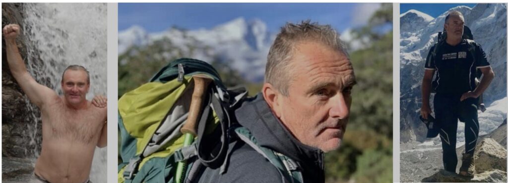
Create the myth . . .
True Spirit Adventures
Around the same time he also established a separate business, True Spirit Adventures, with one of his female trekkers from Melbourne – together they claimed to have ‘identified an opportunity in the market to provide Elite (sic), life-changing and empowering adventures for Charity (sic), Corporate (sic), Teams (sic), Defence Forces (sic) and Schools (sic).’
In the meantime, he was also managing Kokoda Spirit with his wife Michelle from the Queensland Sunshine Coast. He wrote:
‘Wayne and Michelle had a dream to share the story of the courageous and heroic diggers on the Kokoda Track with fellow Australians. Immerse yourself in the cultures of traditional village life, marvel at the size and magnitude of the rainforests and mountains, enjoy the adventure of crossing swift flowing rivers to discover waterfalls, and people living in harmony with their land. Come with us on a journey to experience the Spirit of Kokoda and Papua New Guinea.’
It culminated in the break-up of his marriage in 2013, and a later acrimonious business and relationship bust-up with his female partner from True Spirit Adventures in Victoria.
However, according to his staff on the Sunshine Coast he quickly recovered from the break-ups and moved on with others enamoured with his status as an adventurer, explorer, historian and philanthropist.
Character References
As Wetherall’s company, Kokoda Spirit emerged as the leading company on the Kokoda Trail he was lauded with references from the Australian High Commission, the Kokoda Track Authority and DFAT as the result of his bogus claims and his persuasive sales and marketing skills.
These were evident in his Linkedin endorsements for ‘management’, ‘strategic planning’ and ‘program management’ by the Australian ‘Strategic Management Advisor’ for the DFAT Kokoda Initiative, Mark Nizette MBE:
Some thought it was a crazy-brave initiative to run separate companies across the same Trail – one with your wife in Queensland and the other with a female business partner from Victoria.
Mr Rod Hillman was appointed as CEO to replace Bartlett. It was Hillman’s first trip to PNG and the defaulting on payment of trek fees by Australian operators was the first issue he had to resolve.
Kokoda Track Authority (KTA) records that Kokoda Spirit was the major defaulter in 2008 – they took advantage of an overworked management staff and neglected to pay trek permit fees for 378 trekkers. Wetherall was outed after the KTA CEO, Warren Bartlett, established an ‘audit checkpoint’ half-way across the Trail because he felt there were many more trekkers than permits.
Rather than advise operators who had defaulted on their payments to pay up, the KTA (under Hillman’s leadership) entered into a series of confidential agreements which resulted in undisclosed discounts and payments to the rogue companies which included Kokoda Spirit.
Wetherall’s persuasive sales skills came to the fore during his negotiations with Rod Hillman and they became close friends – so close that Hillman wrote a letter advising that Kokoda Spirit ‘had no outstanding trek fees in 2008, 2009, or 2010’ . He neglected to mention whether these amounts related to the full amount of unpaid fees identified by the Kokoda Track Authority audit, or any reduced amount negotiated as part of a confidential settlement with the KTA.
‘Kokoda Spirit PO Box 7293 Sippy Downs QLD 4556 Australia Re: Confirming Kokoda Spirit has paid all outstanding KTA fees and charges
‘Dear ‘Wayne & Michelle, This letter is to confirm the outcomes of our conversation held on the 26th April in the KTA office. In this discussion I was able to verify;
‘Kokoda Spirit has no outstanding trek permit, or other, fees to the KTA from 2008, 2009 or 2010. Kokoda Spirit has satisfied all requirements to be issued a KTA Commercial Operations License.‘I look forward to working closely with Kokoda Spirit into the future.
‘Regards, Rod Hillman Chief Executive Officer
May 05, 2010
It was noted that Hillman did not write a similar letter to any other trekking company including Adventure Kokoda which had paid all trek fees for the year in full and in advance as required.
On 3 September 2010 Wetherall’s relationship with Rod Hillman was evident in the following announcement on his blog:
‘Kokoda Spirit to manage Kokoda Track Authority Chairman’s Fuzzy Wuzzy Angel Day Trek . . .the VIP participants on this trek have been personally invited by the Chairman and CEO of the Kokoda Track Authority.
Such a trek should have been put out to tender among licensed Kokoda tour operators at the time however there is no evidence of this protocol being followed.
At the end of Hillman’s term as CEO he joined Wetherall’s company, Kokoda Spirit, on a trek across the Kokoda Trail, and wrote a glowing reference as a parting gift on Thursday, 28 June 2012:
Kokoda Track Authority Reference for Wayne Wetherall
‘Wayne and Michelle,
‘Please accept my apologies, belated thanks and appreciation for assisting me to join your trek last year.‘The trek was brilliant and allowed me to spend time with my two sons focused on them instead of organizing/ leading my own trek.
‘Kokoda Spirit’s organization and implementation was a credit to you both. The trek flowed well with competent (obviously well trained) staff who enjoyed their work. From our first meeting on Brigade Hill with the porters performing a welcome dance to flying back to Port Moresby and dinner at the Yacht Club we were treated extremely well. The relationship one of my sons developed with your porter Billy was a highlight. Cameron is excellent. He has a genuine passion for the subject and I thoroughly enjoyed his commentary and leadership of the group. This was my first experience as a ‘trekker’ on the Kokoda Track as all the other times it was work and a very different experience. It was a great insight to the experience trekkers get when they join a tour operator and if everyone supplies the experience Kokoda Spirit does then the Industry is in safe hands. Once again my congratulations and my thanks.
Cheers Rod Hillman
According to a signed statement by Hillman on 8 November 2018, Wetherall advised him that the ‘thousand trekkers’ he claimed to have led across the Trail in 2008 was just a ‘marketing statement and not actual figures’.
Rod Hillman’s credentials can be viewed on this link:
Australian High Commission Refernece for Wayne Wetherall
In 2016 the Australian High Commission went a step further and wrote a personal letter congratulating Wetherall for the ‘great work he was doing on the Track’:
Dear Wayne,
By way of introduction I am responsible at the High Commission for the Australian government work in the Kokoda region.
I’ d like to pass on our congratulations in general to your company for the great work you do on the Track. I see your teams out there, they’re clearly well prepared, your potters are being treated well, and your companies interaction with campsite owners and the local communities is positive. Terrific stuff. It’s great for those individuals involved, both from PNG and Australia, it’s good for the economy, and it helps strengthen the bilateral relationship. Recognise you must be working hard to bring up the number of trekkers – that’s not easy in this economic climate. I’d welcome the opportunity to meet with you if you have time next time you’re around Moresby Always keen to hear and learn more about the Track, and discuss the Australian government approach, including to some of the challenges.
Respectfully yours,
Tim Bryson
Counsellor, Australian High Commission – Port Moresby Ph +675 3259333 Ext. 379 I Mobile + 675 7200 7872 I Fax +675 325 5535 Australian High Commission – Pott Moresby Locked Bag 129, Waigani NCO, Papua New Guinea www.dfat.gov.au
The Australian High Commission failed to write to other trekking companies who had established legitimate charitable foundations, built community learning centres, introduce scholarship programs, initiated agricultural projects, and provided generous support to local schools and health centres.
They obviously lacked the personal charm that Wetherall oozed when he needed to.
The Australian High Commission was obviously unaware that Kokoda Spirit was not (according to the PNG Investment Promotion Authority (IPA) Act, operating in accordance with PNG legislation.
DFAT Kokoda Initiative endorsement for Wayne Wetherall
Skills & endorsements Management Endorsed by Mark Nizette, MBE (mutual connection) Strategic Planning Endorsed by Mark Nizette, MBE and 2 other mutual connections Program Management Endorsed by Mark Nizette, MBE (mutual connection)
Sandakan Spirit

In developing Sandakan Spirit to lead treks across the Sandakan Death March Route he shadowed Lynnete Ramsay Silver AM, author of the highly acclaimed book ‘Sandakan – A Conspiracy of Silence.
Wetherall used the same techniques as he used on the Kokoda Trail by claiming to have ‘opened up Sandakan‘ and ‘discovering ‘part of the original death march route’.
Lynnette Silver, a meticulous historian, author of 10 published books and the official historian for the Australian 8th Division Association was aghast at bogus claims by Wetherall in promoting his Sandakan Death March treks however she was no match for his bogus marketing techniques.
On 11 February 2009 Wetherall advised:
The Brisbane Courier Mail – 7 August 2011
‘A Sippy Downs adventurer and historian says he has found missing links to Australia’s greatest single World War II tragedy, the Sandakan Death March,
‘‘Wayne Wetherall, of tour group Sandakan Spirit, says research, interviews, maps and journals have led him to discover 20km of track lost for more than 65 years . . .
‘Now, Mr Wetherall is adamant he has discovered the “correct” track, with 20km previously unknown across the Maitland ranges between the post-war relocated villages of Mangkadai and Miruru (Milulu).
“You can feel the energy coming out of the ground. This is a significant part of our history,” he said.“It is imperative that the recording of the history of this track is correct. We hope this can be shared with other historians and other people to get a truer picture of what happened out here.
“On our last few trips there we’ve come to realise that tracks run in different directions.”
‘Mr Wetheral said he expected his claims to cause controversy in the history community.
“Some of the information in the past has been quite sketchy,” he said. “There will be some controversy involved, no question, but we believe this is a new section of track.
“We’re not saying that anyone else is wrong, just that we want to get this track right.“It’s an evolving track and we’re finding out more and more about it.”
‘He said he used documents including Japanese records and death certificates of POWs to put the jigsaw together.‘He also interviewed carriers on the original track, now aged in their 90s.
“This has all helped us put together the missing pieces,” he said.“
They spoke about the way the track ran and what they witnessed. They have very descriptive stories.“Carriers were under threat of death if they assisted POWs in those days.”
‘Mr Wetherall and his team will return this Friday to investigate another new section of the track at Lalosing, a dense forest that was once a Japanese camp and POW site during the second world war.‘He will be led by an original carrier from the Death March, named Ambugang, and his son, the chief of Miruru village.
“We will be the first to go into Lalosing since the war,” Mr Wetherall said.“It’s part of the state forest now, we had to seek permission from the Malaysian Government to do it.”
‘He said Sabah Tourism, the Malaysian Government’s tourism office, supported his claims of the new track.
“The history and correct route that these courageous POW walked need to be documented correctly so future generations of Australians can walk in the footsteps of these heroes,” he said.
“We also have a small window of opportunity to interview the surviving locals who witnessed the atrocities before they take this knowledge to the grave.”
‘He said these locals collaborated with him twice.‘Next week is also an important day in the history of the Death March.‘The Sandakan Day Memorial, on August 15, commemorates those who died and suffered on the Death March.’
Sandakan’s Deadly Past
Wetherall’s self-proclaimed ‘historian’ status was betrayed by his statement that he ‘could feel the energy coming out of the ground’ – he was obviously unaware that ‘history’ is more than a vibe!
Lynette Ramsay Silver AM MBE
He also failed to acknowledge the extensive research of Mrs. Lynnette Silver AM had conducted on Sandakan over the previous decade. Mrs. Silver is the official historian to the 8th Division Association. Her research was published in her book ‘Sandakan – A Conspiracy of Silence’, a decade before Wetherall’s ‘discovery’ of the place.
Her research involved painstaking research and interviews with survivors, as well as a study of Japanese records, pieced together a detailed and highly readable account of the lives and ultimate fate of Sandakan’s POW’s. The integration of first-hand accounts and historical records forges a merciless portrayal of the crisp trepidation and unwarranted deception behind what has become WWII’s darkest and most deadly secret.uncovered the fate of 2428 Australian and British prisoners of war who died at the Sandakan POW Camp in Borneo on one of the death marches, and investigated the coverup of a failed rescue mission Operation Kingfisher (World War II). 2004’s The Bridge at Parit Sulong is an investigation into the massacre of allied prisoners by Japanese soldiers in Malaya in 1942. Further books, mainly related to military history, followed.
Silver was awarded an honorary Medal of the Order of Australia (OAM) in 2004 for “service to veterans and their families, particularly as an organiser of battlefield tours and commemorative services”.[1] She was advanced to Member of the Order of Australia (AM) in the 2019 Australia Day Honours for “significant service to the community through historical battlefield tours and commemorative services”,[2] and appointed a Member of the Order of the British Empire (MBE) in the 2024 New Year Honours for services to British families of Second World War personnel.[3]
Mrs. Silver contested Wetherall’s claims in the following blog:
‘The death march track opened up by Tham Yau Kong and Lynette Silver in 2005 follows as closely as is practically possible the route taken by the POWs, retraced and recorded by an Australian Army War Graves team in 1945.
‘The original hand-drawn map plotting this path was given to Lynette in 1995 by Corporal G Robertson, the soldier who drew it.
‘A copy, based on the original, is preserved in Australian Archives and is on public display at the Australian Government Commemorative Pavilion at the Sandakan Memorial Park.
‘A copy of Lynette’s original map is displayed at the Kundasang War Memorial.‘In August 2011, Wayne Wetherall, an Australian tour operator, claimed in media reports that the route being followed by trekking parties was incorrect, and that the POW route had deviated into the Liwagu Valley, to pass through the village of Miruru.
‘He also claimed he had ‘discovered’ a ‘lost’ section of the track, deep in primary jungle.‘Following this announcement, a letter by a Sabahan ‘History Buff’, concerned by the veracity of these claims, was published in Sabah’s Daily Express, initiating a public debate. Lynette’s statement, compiled at the request of the newspaper editor, can be accessed at http://www.dailyexpress.com.my/read.cfm?NewsID=750. Further transcript and additional commentary is at http://blog.kokodatreks.com
‘Reports and body-recovery documentation, the copy of Robertson’s map and wartime maps prepared from intelligence gathered during hostilities by secret agents are held in Australian Archives. This material, coupled with first-hand knowledge provided by several local people, who had walked the track many times while ferrying supplies for the Japanese, show that the POW route did not, at any stage, enter the Liwagu Valley or pass anywhere near Miruru village.
‘This research, carried out by Lynette in the 1990s, and re-checked in 2005, was confirmed in early 2012 by Army historians and mapping experts who, following the 2011 claims, were given the task of making an independent assessment based on all the archival and other evidence. In April 2012 , the Australian Government formally released an official map showing that the death march track followed the route plotted by Robertson. No evidence was found to support the 2011 claim that the track had deviated into the Liwagu Valley or passed through through the village of Miruru.‘Furthermore, the ‘lost’ section had never been lost.
‘It is highly protected Class 1 Forest Reserve, entry to which is prohibited without special permission. It is also in a high risk ‘flash flood’ zone.
‘In the interests of safety, and for environmental and conservation reasons, trekking groups have always used a nearby alternate path, which is safer and far less environmentally-intrusive route.‘For an investigation of the death match route, go to the followqing links:
Mrs. Silver’s confirmation that the ‘lost’ section of the Sandakan Death March Route has never been lost could be applied to Wetherall’s previous claims of lost and forgotten battlefields along the Kokoda Trail which have also never been ‘forgotten’ or ‘lost’.
Mrs. Lynette Silver’s extensive research on the route of the Sandakan death march route can be read on this link:
In the article Mrs. Silver advises:
‘The official documents used to compile this article are all held in Australian National Archives or the Australian War Memorial Collection. The transcripts of interviews, along with the videoed and audio recordings with local people, are preserved in the Silver Papers. A fully referenced version of this paper is held in the Archives of the Sabah State Museum.
However, this did not deter Wetherall from belittling Mrs. Silver’s research by advising:
‘After 79 years, you can walk the Sandakan Death March track in the footsteps of those heroes.
‘With Sandakan Spirit as your trekking company, you’ll be participating in both a personal discovery experience and an historic Borneo adventure.‘That’s because our treks across the Sandakan Death March follow the original route as closely as possible. We avoid using “short cut”, “eco” or alternative tracks that are logistically easier, ensuring that you see the real Borneo, and the original Sandakan Death March Route. . .
‘We avoid using short cut or alternative treks that are logistically easier to ensure you see the real Borneo, the real Sandakan Death March Route. We use a variety of accommodation on our treks including camping next to Rainforest Rivers and staying in traditional Dusun Villages along the way, this gives you a great chance to embrace the traditional culture and mix with the locals and hear firsthand the stories of their forefathers.‘If you are comparing Sandakan trekking companies, make sure you are on the correct route.’
Route to Great Cruelty
He closed his blog with the expected advertisement for his business:
In an article titled ‘The route to great cruelty’ the New Strait times in Sabah reported:
‘ He (Wetherall) said the lost route was discovered based on information from various sources such as the Australian War Graves, grave recovery maps, National Archives and Australian War Memorial.
“Some of the most compelling intelligence that we have gathered came from local people along the route, including the village chiefs of Taviu, Mankadai and Miruru in Ranau,” Wetherall said.
Unlike Mrs. Silver, Wayne Wetherall does not reference any of the ‘compelling intelligence’ he gathered from village chiefs and does not provide any GPS readings to support his ‘research’ as would be normally expected of a ‘passionate historian’ as he claims to be.
‘Profit Motive’ in new Death March
The following letter, ‘Profit motive’ in new Death March, published in the Daily Express (East Malaysia) by ‘History Buff’ on 25 September 2011 indicates that Wetherall adopted the same ambush marketing strategy on the Sandakan Death March route as he used to develop his business along the Kokoda Trail:‘
A so-called ‘expert’ has lately surfaced making claims about newly-discovered ‘lost tracks’ of the infamous Death March route of World War Two.
‘He has made claims he has spoken to villagers and the original route used by the POW’s and the Japanese near the village of Miruru when this is not the case.
‘A number of villagers interviewed in the Miruru area deny ever speaking to him and the Sabah Society research of 2005-2006 concluded the route did cut through the Miruru area before the prisoners had to wade across a major river to get to Tampias.
‘The issue, however, was if they carried on through the marshland to get to the river before crossing over or went up the top of the ridge and back down to cross over. This has never really been proven even till today.
‘The Sabah Society’s findings differ from author Lynette Silver and her research but this has not caused problems thus far as most experts agree it is hard to determine the actual route given there were several marches between Sandakan and Ranau and because prisoners were executed and marched along different parts of the section in question during that period of time.
‘So it is impossible to prove anything beyond reasonable doubt.
‘Much of what this Australian ‘expert’ claimed appears to be old news as the Sabah Society and Tham Yau Kong had done much of the work in 2005 establishing the actual route and the use of Miruru during the actual march before this Australian even got to Sabah and walked the route with Tham several years later . . .
‘We now have a situation where an Australian is now claiming to have made dramatic discoveries when it clearly isn’t the case and is using this to gain media mileage at the expense of Sabahans.’
Wayne Wetherall’s Writings
A review of Wetherall’s writings regarding his ‘discovery’ of Sandakan are similar to the approach he used to differentiate himself from other tour operators in the development of his Kokoda Spirit business six years earlier via his website blogs[i]
Unlike Lynette Silver he does not reference any conversations he has supposedly had with individuals along his version of the Sandakan Death March Route, nor does he provide any GPS readings to support his assertions.
‘it was like entering a lost world, the jungle was thick, dark, steamy and brooding.
The track was steep, slippery, brutal and unforgiving, it was difficult staying upright. No white man had trekked this toughest section of the track since the POW’s marched it 66 years ago . . .
This is an important find and is now part of our standard itineraries for our treks. . . We avoid using “short cut”,“eco” or alternative tracks that are logistically easier to ensure you see the real Borneo, the real Sandakan Death March Route.
In a condescending slight to Sandakan historian, Mrs. Lynette Siver, he wrote:
‘It was great to read the article in the Sydney Morning Herald of the continued involvement of Miltary (sic) Historian and Veteran (sic) Trekker (sic) Lynette Ramsay Silvers (sic) association of walking and leading treks across the Sandakan Death March this year with Tham Yau Kong.
It is also interesting that it is possible to pay extra for Lynette Silver to accompany you on a TYK trek.
A review of Wetherall’s Kokoda Spirit website reveals that he adopts the same method on his treks across the Kokoda Trail as locally led treks are cheaper than those he leads!
On 3 August 2011 he issued a Media Release titled ‘Every Aussie has a right to know!:
‘CORRECTING AUSTRALIAN WAR TIME HISTORY!
‘Parts of the Lost Death March Track in Sabah Borneo uncovered.
Trekkers now on the right Track
The Sandakan “death march” is the greatest single World War 2 tragedy in Australia’s History. Yet this story remains virtually unknown to so many.
Wayne Wetherall an expert trekker and passionate historian has uncovered the lost sections of the “Death March Track” of Sandakan, he has become a voice for the thousands of brave Aussie Men who never came home.
Links:
Wetherall’s claim was contradicted by ‘History Buff’ in the Daily Express (East Malaysia) on 25 September 2011 (see above) who advised:
‘We now have a situation where an Australian (Wayne Wetherall) is now claiming to have made dramatic discoveries when it clearly isn’t the case and is using this to gain media mileage at the expense of Sabahans.’
On 21 November 2011 Wetherall posted a blog titled ‘Borneo Track Claim’
In the blog he attempted to justify his claim of to have discovered two new sections of the Sandakan Death March Route ‘after intensive research and interviews with those who witnessed the attacks on Australian soldiers’. According to Wetherall:
‘The real answers for us have been actually walking through the jungle and talking to the local people aged in their 90s now who were the carriers.‘His research also included piecing together information from the Australian Office of War Graves recovery maps, Japanese death certificates and the Australian War Memorial archives
He went on to explain:
“We were the first people to actually go into this section of the forest called Lolosing and it was primary Borneo jungle deep, dark, with vines coming down everywhere,” he said. “We had with us an 80-year-old who was a carrier for the Japanese, and he was showing us where the commander’s building used to be and where he saw an Australian soldier killed.
“It was chilling stuff to be there with him. It’s going to be an ongoing project because there is still much more left to discover.”
‘Over the past two journeys he and Jerome and his team of local Dusun’s, who are direct descendents of the carriers and villagers along the track have meticulously, using the latest in GPS mapping technology and old fashion hard work we were able to faithfully piece together as close as what they believe to be the original route.
He then fell back on the familiar mantra he used soon after he ‘discovered’ the Kokoda Trail six years earlier that ‘We see things as an explorer, historian and adventurer.
‘When you trek the Sandakan Death March with Sandakan Spirit, you’re participating in a personal discovery experience; you are truly living and participating in an historic and monumental Borneo adventure.‘After sixty six years, you too can now walk the Sandakan Death March track in the footsteps of the Sandakan Death March heroes.’
Lynette Silver’s Rebuttal
The last word goes to Mrs, Lynette Silver:
‘The Sabah Society walk, led by Tham Yau Kong in 2005, went the wrong way because author Kevin Smith, whom Wayne Wetherall relies upon, had produced a ‘map’ of the death march showing the track going through Miruru and Mangkadai villages.‘
He had latched onto the words Miruru and Mangkadai because I had given these places as places of death for POWS, as shown on Japanese wartime documents which Smith had never seen.‘
Well, when you appropriate someone else’s research you need to know what you are stealing.‘Miruru was the name given by the Japanese to the climb up Taviu Hill, and Mangkadai to a stretch to the east.‘
The reason for the naming was because the entire area was unexplored and uninhabited.‘
They had to bring in labour from villages in another valley, along the Labuk River.‘These villages, Miruru and Mangkadai, were far away, with Miruru on the far side of the Labuk. ‘
However, when a road was built linking Ranau to Sandakan in the 1970s, the villages moved to be closer to the new road, as they were no longer dependent on river travel.
‘Smith latched onto the words Miruru and Mangkadai and assumed they went through the modern day villages. He then published his shonky map in his book and it was taken at face value.‘
It was not until I asked why the Sabah Society had gone into the wrong valley that Tham Yau Kong found that Smith’s map was completely wrong.
‘When I produced the original 1945 map, drawn by the recovery teams, we were able to follow the rivers marked, crossing the numerous marked tributaries, to identify where the track went. The route was confirmed by at least five locals who had worked for the Japanese as coolies and had walked the track many times. They physically showed us where it went.
‘Wayne Wetherall got hold of Smith’s bogus map, and announced that he had found the correct path. His groups and those associated with him go completely the wrong way.
‘When challenged, Wetherall claimed that there was an ‘alternate’ route, despite the fact that villagers refute his story entirely. Business is business is the credo and unfortunately local business interests tainted by Wetherall’s claims have no interest in historical facts.
When you ascertain where old Miruru and old Mangkadai were, the absurdity of this claim becomes even more obvious.
Can you believe that a local guide took 100 serving members of the Australian Defence force on a so called death march trek very recently, following the bogus route?
In September Wetherall also took a group of students along the same route now promoted as the Sandakan Memorial Track.
Very embarrassing, given that the Australian defence experts produced the official map, with the Australian Coat of Arms on it, which was launched in 2016 to put an end to all this nonsense.
AND, someone connected to Smith (now deceased) has ALTERED the official map on display at Ranau to show the’ alternate’ route. It is behind glass, so I can’t rectify it.
To the uninformed It looks as if the government and defence agree that there is a second route, no matter how stupid that idea is.
2025 Update from Lynette Silver in Borneo
‘Far from endorsing the Wetherall route, Sabah Tourism Board has now produced, en masse and for free, a map of the route from Sandakan to Ranau, based on the official map produced by the Army History Unit and Army mappIng team. This map is universally accepted as correct, as it is based on the wartime map drawn by the war graves recovery teams.
‘One side shows the route, the other has 15 key places that can be accessed if travelling by car. Black and yellow signs, with six POW figures, have been erected to direct motorists.
‘The new map incorporates a viewing platform that overlooks the original tortuous climb along the Lolosing ridge. This passes through highly protected class 1 forest and is too dangerous for trekkers to use without express permission, rarely granted.
‘To date permission has only been granted to a British military group and an Australian army group, due to tackle it in August 2025, provided conditions are favourable.
‘Wetherall’s claim that he would be the first to venture into Lolosing is sheer nonsense. Tham Yau Kong and his jungle guides were the first, in 2005, when locating the route from the wartime map. Since then, one is allowed into that zone without the express permission of the forestry officials.
‘The new map should put to an end his ridiculous claim that the death march route went into the adjoining Labuk valley and passed through present day Miruru and Mankadai villages, which, in 1945 were a great distance away, on the other side of the Labuk River.
‘The Lolosing track has never been lost, as it is clearly marked on the wartime map, and in consequence, the Forestry Department has erected a viewing platform so that people interested in the story can see where the original path went.’
‘ Adventurer, Businessman, Founder and Owner of Life Changing Adventure Companies, Passionate Australian . . . Wayne Wetherall has also been involved in uncovering the missing links of the Sandakan Death March track, which is described as Australia’s worst Military Tragedy of WW2.
Wayne Wetherall Fact Checks:
Wetherall’s claims achieved their purpose in cultivating his own myth as an ‘explorer’, ‘adventurer’, ‘historian’ and philanthropist, obsessed with a ‘passion for our soldiers’ which resulted in his trekker numbers increasing exponentially – his previous life as a sales manager for a suburban air conditioning company has long been airbrushed from his CV and archived.
The following fact checks are more revealing:
Date of Birth: 3 May 1965
1995-1996: NSW Technical Sales Manager, Kirby Refrigeration
1996-1999: NSW State Manager, Kirby Refrigeration
1999-2002
NSW State Manager, Actrol Pty Ltd
Actrol is a wholesaler of parts to the refrigeration, air conditioning and allied industries.
2002-2003
National Sales Marketing Manager, Reliance Grou0/TubeFit
Note: ‘TubeFit’ does not generate any results in the Reliance Group Search Engine – it is not possible to gauge the extent of Wetherall’s ‘National’ responsibilities in this position.
2003-2006
National Sales Marketing Manager, RES (Refrigeration Equipment Supplies)
Note: RES does not have a website – it is therefore not possible to gauge the extent of Wetherall’s ‘National’ responsibilities in this position.
2004:
Kokoda Spirit Pty Limited (ACN:111 575 378) registered with ASIC 0n 28 October 2004.
2005:
Kokoda Spirit (PNG) Limited (1-47149) registered in PNG on 16 December 2005.
The following is an extract from the first Kokoda Spirit website on 11 February 2005:
‘Kokoda Spirit is passionately committed to the legacy and Spirit (sic) that our Australian Soldiers (sic) and their Papuan New Guinea Brothers (sic) have left for us on the Kokoda Track (sic). The Courage (sic), Endurance (sic), Mateship (sic) and Sacrifice (sic) on this sacred track have become legend. We at Kokoda Spirit are dedicated to providing our Trekkers (sic) and Rafters (sic)with the Experience (sic) of a Lifetime (sic), to Experience (sic) Adventure (sic), to Experience (sic) the Spirit (sic) and to Experience (sic) the Culture (sic) and the People (sic) this wonderful, fascinating and awe inspiring Country (sic) provides.
‘At Kokoda Spirit we are always at the forefront of new adventures in PNG. We have successfully explored and opened up 3 new rivers in PNG. We can also organise treks to Mt Wilhelm and Mt Victoria. We are also opening up trips to Alotau at Milne bay and Buna and Gona on the North Coast (sic). Kokoda Spirit has offices in both Sydney and Port Moresby. This allows us to provide you with local contacts in Australia, while our strategically based Port Moresby office provides all the advantages of local knowledge and local infrastructure. This support network ensures your trekking or rafting adventure is enjoyable and trouble free.‘Our Australian office and operation is run by Wayne Wetherall and Frank Hasiuk. Both these men are passionate about the Kokoda Track (sic), the Australian history, the people and the culture. Both Wayne and Frank have accompanied “Ossie” on the Kokoda Track (sic) and his explorations of the PNG rivers. They have established strong bonds with the local villagers, setting up trusts to supply much needed supplies of School books and equipment. Wayne and Frank’s expertise in Business (sic), IT and Tourism (sic) provides the professional support and infrastructure to the team in Papua New Guinea. Wayne Wetherall has an intimate knowledge and passion for the Australian war history on the track and is our Chief Australian Guide. He has also written a number of stories on the history and his experiences on the track. His enthusiasm and knowledge will give you an insight into the Kokoda Tracks (sic) history.
‘Kokoda Spirit has also run small group trips to explore the history and sites of Sri Lanka, Thailand, Vietnam, China and Borneo. (Details on request.)‘Wayne Wetherall achievements in Brief:‘Kokoda Spirit is the only Trekking/Rafting Company (sic) in PNG. Kokoda Spirit is also the only commercially operated Rafting (sic) company in PNG. Kokoda Spirit can offer you rafting at the completion of your trek – either on the Kumusi River near Kokoda or on the Vanapa and Angabanga Rivers near Port Moresby.’
| FACT CHECK: Kokoda Spirit ventures into white-water rafting in PNG ended after three Israeli rafters were drowned on one of their expeditions in May 2005. There is no record of Wayne Wetherall and Frank Hasiuk ‘setting up trusts to supply much needed supplies of School books and equipment’ for local villagers in 2005. There is no record of Wetherall publishing ‘stories on the history and his experiences on the track’ prior to 2005. There is no record of Kokoda Spirit organising or leading ‘small group trips to explore the history and sites of Sri Lanka, Thailand, Vietnam, China and Borneo’ prior to 2005. Prior to 2004, Frank Hasiuk worked in Real Estate in South-Western Sydney. According to a PNG guide on his first trek across the Kokoda Trail in 2004 he provided the funding for Wetherall’s initial ventures into PNG – he was mentioned on the Kokoda Spirit website for a short time before being removed. According to Wetherall’s LinkedIn profile he was employed as the National Marketing Manager with Refrigeration Equipment Supplies from 2003 until December 2006. |
Celsius Journal: Vol 34. No 5. May 2006. Page 14. Industry News – The Official Journal of the Refrigeration and Air Conditioning Contractors Association of Australia
‘Wayne Weatherall is the National Sales Manager for RES. Wayne has been a great help assisting us with Worldskills.’
| FACT CHECK: It is difficult to understand how Wetherall could have been ‘at the forefront of new adventures in PNG; exploring and opening and opening up new rivers in PNG; and opening up trips to Alotau, Buna and Gona whilst he was employed as the National Sales Manager for Refrigeration Equipment Supplies at the same time in 2005-2006. There are no known records of his ‘exploring’ and ‘opening up’ of ‘new adventures’ in any of these locations – it can therefore be assumed that he made them up to enhance the myth he was cultivating in the early years of his involvement with the Kokoda Trail. |
According to an interview with the Sunshine Coast Daily newspaper on 15 April 2009 he informed the reporter, Anne Lousie Brown, that he was:
‘a building industry sales executive, but “had a nagging need” to make his Kokoda Spirit dream come alive.’
| FACT CHECK: There are no known records of Wayne Wetherall’s engagement in the building industry as a sales executive. He has not mentioned this fact in his Linkedin profile or any other forum. It is possible he might just have been trying to impress the young female reporter. |
2011:
THE AWCI 66th Annual Conference:(Association of Wall and Ceiling Industries) – Reef View Hotel, Hamilton Island, QLD: 6-9 November 2011
Motivational Speaker: Wayne Wetherall
‘Wayne Wetherall is currently the owner and Managing Director of Adventure companies, Kokoda Spirit and Wild Spirit Adventures. Wayne had a very successful career in the corporate world as a National Sales and Marketing Manager and General Manager, until in 2004, he walked the Kokoda Track in PNG; a life changing experience that he has turned into a passion and lifestyle.‘In 2007 he took on the fulltime role as Managing Director of his own company Kokoda Spirit, which quickly became Number One operator of adventure treks across Kokoda and PNG, escorting over 4000 trekkers across the track. Wetherall’s adventure company has now expanded into Borneo, Africa and Nepal, with his passion to deliver life changing adventures.’
| FACT CHECK: Wayne Wetherall established his myth on the pillar of his international, national, and state athletic records which were listed on the Kokoda Spirit website on 11 February 2005. They were quietly removed from the website after the aura of the adventurer, explorer, and historian with a passion for our soldiers had been established. If Wetherall’s athletic records were true it is fair to assume they would have featured in his profile as a ‘motivational speaker’ of some note at the AWCI 66th International Conference in 2011 – that’s what motivational speakers do! |
Wayne’s expertise in Adventure tourism, Business, Management, Leadership, Motivation and Life changing experiences, provides the professional support and infrastructure to the team in Papua New Guinea. Wayne has had a very successful career in the corporate world as a State Manager, National Sales and Marketing Manager and General Manager.’
| FACT CHECK: According to Annual Returns submitted for Kokoda Spirit PNG, Wetherall did not have a ‘team in Papua New Guinea’ as the company did not employ any full-time or part-time employees. |
‘Founded in 2004 by adventurer, Wayne Wetherall, Kokoda Spirit began with an earnest desire to experience a legendary track that was once all but forgotten to time until a small band of Soldiers trekked into the interior of Papua New Guinea and fought back an invading Japanese force during World War II. This formidable frontier became known as the Kokoda Trail Campaign.’
| FACT CHECK: It is a stretch to relate the term ‘adventurer’ to the various suburban sales manager positions listed on his Linkedin profile prior to 2004. |
According to Wayne Wetherall’s Linkedin profile he has also ‘thrown himself out of a perfectly good plane skydiving 4 times’, and ‘caged dived with the Great White sharks off Port Lincoln’.
| FACT CHECK: Wetherall didn’t actually ‘throw himself out a perfectly good plane skydiving 4 times’ as claimed. According to Skydive.com.au a parachutist must have completed nine AFF training stages which involve assisted jumping ‘with two instructors holding on to you’ before one is permitted to jump solo. This FB post indicates that Wetherall participated in a ‘tandem jump’ firmly attached to the bosom of a qualified parachutist in the same fashion as this 95-year-old skydiver. According to Shark Diving in Port Lincoln: ‘Our crew strive to ensure all groups get a similar experience in the cage, based on shark interaction . . . Please remember that the day isn’t just about being in the cage as there is also ample viewing opportunity from on board the vessel while waiting for your turn to dive’. |
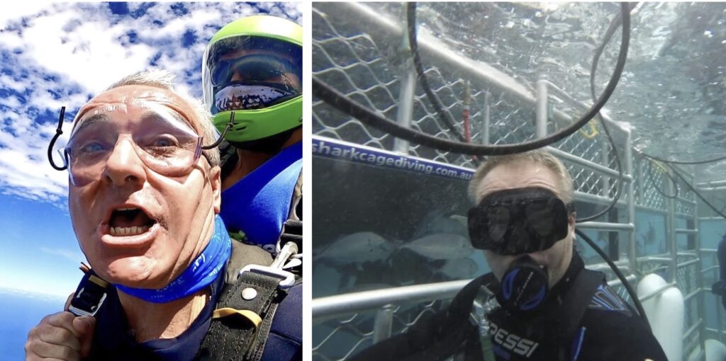
Wetherall ‘throwing himself our of a perfectly good plane’ (firmly attached to a qualidied parachutist) & cage diving with what appear to be ‘white-pointer fish‘
Trolling for the Truth re Number of Treks claimed by Wayne Wetherall
At the end of 2008, the Australian Government assumed responsibility for the Kokoda Trail under a Joint Understanding signed with PNG.
Trolling for the truth regarding Wayne Wetherall’s claims on the Internet Archive Wayback Machine is a difficult, time-consuming exercise which leads to the conclusion that he either has mathematical dyslexia, a poor memory, or he just makes things up.
Wetherall fails to explain how he could have led 11 treks across the Kokoda Trail when it was closed during Covid and there were no flights between Australian and PNG! and no treks!
| YEAR | KOKODA SPIRIT WEBSITE CLAIM | COMMENT |
| 2010 | Reference (18 November 2010): Kokoda Spirit led 3000 trekkers | |
| 2011 | Reference (11 January 2012): Kokoda Spirit led 3800 trekkers | |
| 2012 | Reference (13 January 2013): Wetherall completed 50 treks Kokoda Spirit led 3600 trekkers | Kokoda Spirit seems to have ‘lost’ 200 trekkers in 2012! |
| 2013 | Reference 1 (25 May 2013): Wayne Wetherall announces his retirement from trekking after completing 50 treks. Reference 2 (26 January 2014): Wetherall completed 55 treksKokoda Spirit led 4000 trekkers | |
| 2014 | Reference (13 December 2014): Wetherall completed 56 treksKokoda Spirit led 4000 trekkers | According to this post Kokoda Spirit led 400 trekkers across the Trail in 2013 & 2014. |
| 2015 | Reference 1 (27 February 2015): Wetherall completed 56 treksKokoda Spirit led 5000 trekkers Reference 2 (5 November 2015): Wetherall completed 60 treksKokoda Spirit led 6000 trekkers | According to the two references for the same year Wetherall either did not trek at all – or he did 6 treks, with Kokoda Spirit leading either 1000 or 2000 trekkers. |
| 2016 | Reference 1 (5 March 2016): Wetherall completed 65 treksKokoda Spirit led 5000 trekkers Reference 2 (27 December 2016): Kokoda Spirit led 6000 trekkers Reference 3 (27 December 2016): Wetherall completed 70 treksKokoda Spirit led 7000 trekkers | According to these references, Wetherall either completed nine treks or 14 treks in 2016 with Kokoda Spirit leading minus 1000 trekkers, nil trekkers, 1000 trekkers, or 2000 trekkers According to Kokoda Track Authority records only 477 trek permits were issued to Kokoda Spirit in 2016. |
| 2017 | Reference 1 (29 December 2017): Wetherall completed 70 treksKokoda Spirit led 6600 trekkers Reference 2 (26 February 2018): Wetherall completed 80 treksKokoda Spirit led 7000 trekkers Reference 3 (26 February 2018): Kokoda Spirit led 7500 trekkers Reference 4 (22 March 2018): Wetherall completed 80 treksKokoda Spirit led 7500 trekkers Reference 5 (31 March 2018): Kokoda Spirit led 7000 trekkers | According to these references Wetherall either completed 5 treks or 15 treks, with Kokoda Spirit leading either 1600 trekkers, 2000 trekkers, or 2500 trekkers in 2016. According to Kokoda Track Authority records only 464 trek permits were issued to Kokoda Spirit in 2017. |
| 2018 | Reference (11 August 2018): Wetherall completed 82 treksKokoda Spirit led 7700 trekkers Reference (9 January 2019): Wetherall completed 91 treksKokoda Spirit led 8400 trekkers | According to these references Wetherall completed either 2, 11, 12, or 21 treks in 2017, and Kokoda Spirit led either 200, 700, 900, 1100, 1400, or 1800 trekkers across the Trail. The Kokoda Spirit staff in 2018 included Wetherall and two female administrators. In 2018, according to the Kokoda Spirit and Wild Spirit Adventures websites they advertised: 74 treks to Mt Kilimanjaro in Africa;26 expeditions to Everest Base Camp in Nepal; 7 treks to the Sandakan Death March in Borneo;62 treks across the Kokoda Trail. This amounts to a total of 169 international expeditions. If Wetherall completed up to 21 treks as claimed he would have been absent from his home office for up to 10 months months leaving the bulk of the work to his two female staff. |
| 2019 | Reference 1 (12 August 2020): Wetherall led 85 treksKokoda Spirit led 8900 trekkers Reference 2 (30 October 2020): Wetherall completed 80 treksKokoda Spirit led 8500 trekkers | Wetherall completed either minus two treks or three treks while Kokoda Spirit led either 500, or 1200 trekkers. |
| Trekking across the Kokoda Trail ceased in November 2019 due to Covid-19 | ||
| 2020 | Reference (19 January 2021): Wetherall completed 85 treksKokoda Spirit let 8500 trekkers | No treks were conducted across the Trail in 2020 due to Covid-19 restrictions. |
| 2021 | Reference (31 March 2021): Wetherall completed 91 treks Kokoda Spirit led 8400 trekkers Reference (19 September 2021): Wetherall completed 95 treks Kokoda Spirit led 8900 trekkers Reference (4 December 2021): Wetherall completed ‘more than 90 treks’ | No treks were conducted across the Trail in 2021 due to Covid-19 restrictions. |
| 2022 | Reference (19 August 2022): Wetherall completed 95 treks Kokoda Spirit led ‘more than 10,000 trekkers’. | |
| 2024 | Reference (27 February 2024): Wetherall led ‘more than 99 treks’ Reference (18 May 2024): Wetherall led ‘in excess of 95 treks’ Reference (2 June 2024): Wetherall led ‘in excess of 90 treks’ | |
- Wetherall’s ‘Kokoda Spirit’ website currently claims that he has led 102 crossings of the Trail.
- Wehterall’s ‘Wild Spirit Adventures’ websited currently advises he has completed 95 crossings of the Trail.
