Kokoda Trail Topographical Map
Trekking the Kokoda Trail in Papua New Guinea will be a little easier with the release of the first topographical map to be produced in 37 years.
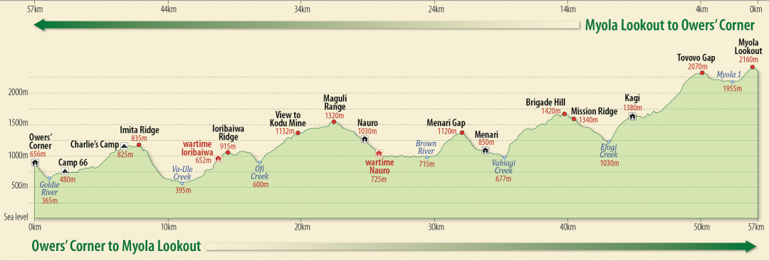
The map has a scale of 1:50,000 and contains contour lines with spot heights and Global Positioning System Grids; the location of wartime villages, battle-sites, fire-support bases and logistic support areas; detailed map inserts for each major battle of the Kokoda campaign; villages, campsites, lookouts, water points; and traditional and wartime names of mountains, rivers, creeks and significant features.
3 Comments